In the spring of 1874, a family named Creedle moved into a two-room cabin on the eastern edge of Dripping Creek Bend, a small trading settlement tucked in a valley in the southern Missouri Ozarks. The Creedles were the fourth family to settle there that year, drawn by cheap land and the promise of fertile soil. By autumn, they were the only ones who remained. The others had not died, and they had not moved west.
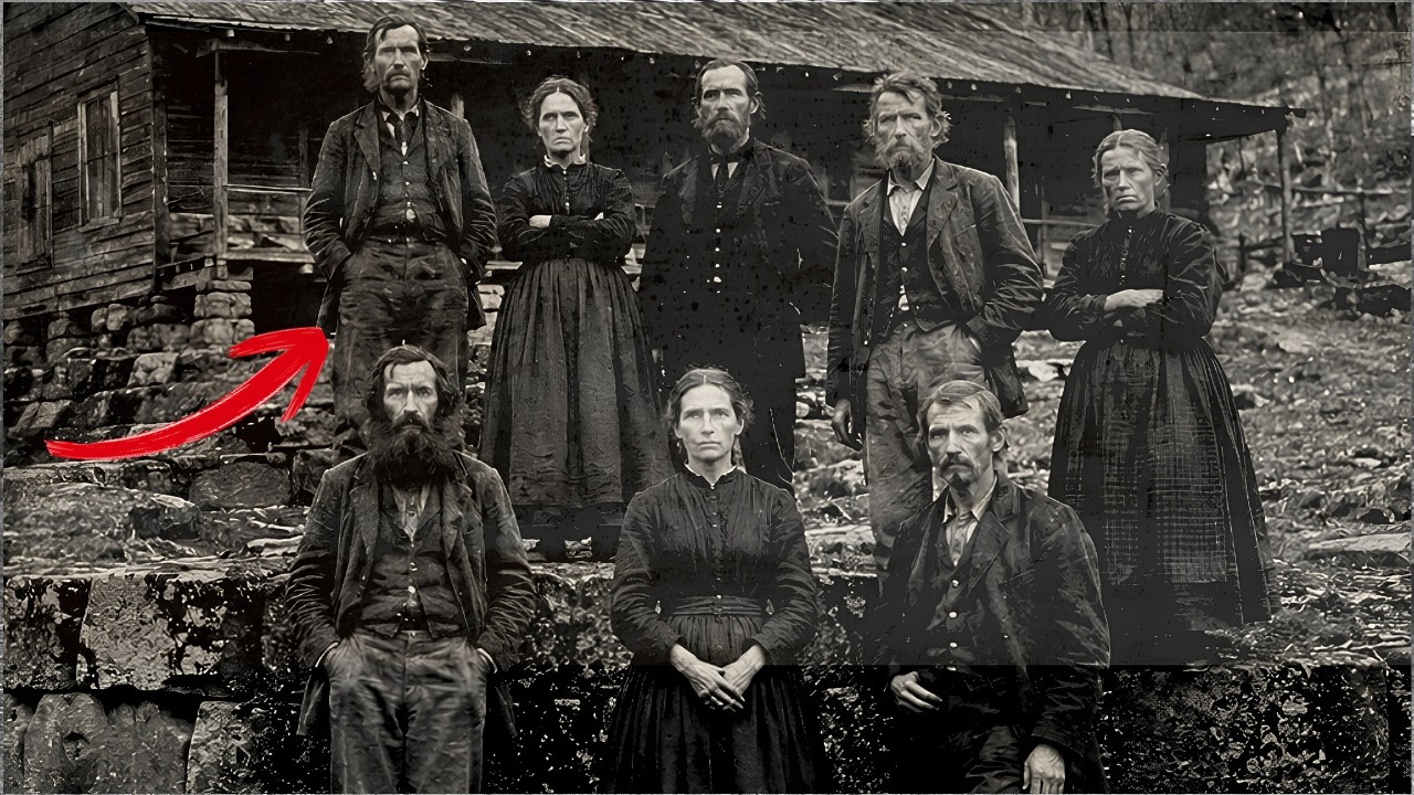
According to three separate letters archived in the Taney County Land Office, the other families simply departed in the middle of the night, leaving everything behind—livestock, furniture, clothes still hanging on the wash line. One family, the Yokums, left a pot of beans on the stove that was still warm when a neighbor found it the next morning. Whatever drove them away had not given them time to pack. For decades, the accepted explanation was simple.
The Ozarks were harsh country. Families came and went. People gave up. But that explanation did not account for what those families told relatives after they fled.
The letters described the same thing independently, with no coordination between the writers: sounds coming from beneath the ground at night, shadows moving among the trees after sunset, and an unmistakable feeling that someone, or something, was watching them from below. To understand what happened at Dripping Creek Bend, you first have to understand where it was located—and, more importantly, what was beneath it. The southern Missouri Ozarks sit above one of the largest karst formations in North America. Karst is a type of geology formed by the slow dissolution of soluble rock, primarily limestone and dolomite, over hundreds of millions of years.
Water seeps into the stone, the stone dissolves, and what remains is a landscape riddled with sinkholes, springs, underground rivers, and caves. Missouri alone has more than 7,000 documented caves. The official number is certainly higher because large parts of the Ozarks have never been systematically surveyed. The terrain was too rugged, the population density too thin, and in many cases, residents had no desire to tell outsiders what lay beneath their property.
In 1874, the Ozarks were still frontier territory. The Civil War had ended less than a decade earlier, and the region had been torn apart by guerrilla warfare. Whole communities had been displaced, farms burned, families scattered. Roads were dirt trails washed out by floods every spring.
The nearest telegraph station was often a full day’s walk away. Mail service was irregular at best. This was not a place where information traveled quickly, nor a place where official records were well kept. The bend was named after Thomas Dripping, a fur trader and occasional mineral prospector who had run a small trading post in the area since the late 1850s.
He chose to settle in that particular hollow for a specific reason: there was a year-round spring at the base of a rocky bluff on the north side of the bend, and the soil in the low ground was rich enough to support crops. What Dripping apparently did not know, or did not care about, was that the rocky bluff itself was hollow. The limestone formation that made up the northern wall of the hollow was part of a much larger cave system. This was not unusual in the Ozarks—bluffs riddled with caves were everywhere.
But the system beneath Dripping Creek Bend differed from typical Ozark caves. The entrances were not visible. There were no wide openings in the rock face, no visible mouths that a passerby might notice. The access points were carefully hidden.
Some were concealed behind rockfalls that looked natural but, according to later descriptions, were too deliberate to be accidental. Others lay at the bottom of sinkholes, reachable only by descending ten to fifteen feet through tangled vegetation. The first documented mention of these hidden entrances came in a letter written by Ephraim Yokum, the same man whose family left the pot of beans on the stove. Yokum wrote to his brother in Springfield in September 1874, about three weeks before his family fled.
He described finding a passage behind a collapsed section of the bluff while searching for a stray hog. The passage, he said, was too regular to be natural. The walls were smooth, not rough limestone—smooth, as if carved by hand or by some tool he could not identify. Yokum did not venture far inside.
The air coming out of the passage was cold and carried a smell he described as mineral and damp, like wet iron. He also heard something—a faint rhythmic sound he compared to breathing, but too deep and steady for any animal he knew. In October 1874, after the Yokums and two other families had already abandoned the settlement, the Taney County Land Office sent a surveyor named Cornelius Harlan to assess the properties. This was standard procedure.
When families abandoned their land claims, the land reverted to the county and had to be resurveyed before being reassigned. Harlan was an experienced surveyor who had worked across southern Missouri for nearly a decade. He was not the type to fabricate stories. Harlan arrived at Dripping Creek Bend on October 14 and spent four days in the valley.
His official survey report, submitted to the county on October 22, was dry and technical—boundary measurements, soil assessments, descriptions of existing structures. But there was a second document: a personal field journal Harlan kept alongside his official records. This journal was not published until 1923, when Harlan’s grandson donated it to the Springfield Historical Society. It tells a very different story.
On his second night at the bend, Harlan wrote that he woke after midnight to what he called a procession of figures moving along the tree line on the north side of the valley. He counted eleven of them. They moved single file, silently, from west to east along the base of the bluff. They were upright, human-shaped, but something about their movement was strange.
He used the word “deliberate. ” They moved with a slowness and precision that did not match the natural gait of humans. He said it looked like people remembering how to walk. Harlan watched from the doorway of the Creedle cabin where he was sleeping.
The figures reached a point near the eastern end of the bluff and disappeared one by one. He could not see their exact destination due to the dense trees, but he marked the approximate location on his field map. The next morning, he went to that spot and found one of the hidden entrances Yokum had described—a narrow gap in the rock hidden behind a pile of fallen stones. The opening was barely wide enough for a man to pass through sideways, but the floor of the passage was polished, not by water, but by feet.
Harlan entered the passage on the morning of October 16, 1874. He brought a lantern, a spool of twine, and a sidearm. The twine was standard surveyor practice—you tie one end at the entrance and unspool it as you walk so you can find your way back. Harlan noted that he used nearly 400 feet of twine before he stopped.
Most natural Ozark caves either open quickly into larger chambers or narrow and dead-end within about 100 feet. This passage did neither. It maintained an almost constant width of about four feet and a height of about six feet along its entire length. The walls were not natural stone formations.
Harlan described them as dressed—worked, the way a mason dresses building stone. The surface was flat and even with clear tool marks running in parallel lines. At the 400-foot mark, the passage opened into a chamber Harlan estimated at 40 feet wide and perhaps 20 feet high. The ceiling was supported by what he called columns, though he noted they did not look like natural columns formed by the fusion of stalagmites and stalactites.
They were too symmetrical, too evenly spaced, and they were square, not round. The chamber contained objects. Three stone platforms, each about four feet long, two feet wide, and raised about 18 inches off the floor. A series of shallow channels cut into the floor running from one side of the chamber to the other in a grid pattern.
And along the walls, carved into the limestone at about eye level, a series of marks Harlan called symbols—but he did not attempt to interpret them. Harlan spent about two hours in the chamber. He sketched the columns, platforms, and several of the wall markings. The platforms puzzled him.
They were too narrow to be beds, too low to be tables, and too precisely shaped to be natural formations. Each was identical in dimensions to the others. Harlan noted that the surfaces of the platforms were slightly concave, as if formed by long use, just as a stone step in an old building wears down in the middle from the passage of feet over centuries. He touched one and recorded that the stone was warm.
Not warm as in alive, but a degree or two warmer than the surrounding rock, noticeable to the hand. The symbols on the walls were arranged in horizontal bands at roughly five feet from the floor. They were not random scratches or graffiti. Harlan counted 47 individual symbols on the wall segment nearest the entrance, arranged in what appeared to be rows and columns.
Some symbols repeated; others appeared only once. He could not identify any pattern resembling an alphabet or numbering system he knew. Harlan also recorded that the ceiling of the chamber was covered with dark residue concentrated above the platforms. He described it as soot or carbon deposits, the kind of staining left by torches or oil lamps on stone after long use.
This was significant because it meant the chamber had not only been built, but used regularly—for long enough to leave permanent staining on the stone above the places where people sat or worked. One additional detail Harlan underlined twice in his journal: the air in the chamber was moving. There was a steady, tangible draft coming from somewhere deeper in the system. The draft was strong enough to make his lantern flame bend at an angle.
This type of airflow in a cave system indicates a large open space somewhere ahead, acting as a reservoir that breathes in response to atmospheric pressure changes on the surface. The passage did not end at this chamber. It continued. Harlan did not go further.
He wrote that he had exhausted his twine and that the draft carried sounds he could not identify—tonal, not wind noise or water, but something with a pattern. He left the chamber, followed his twine back to the surface, and sealed the entrance by restacking the scattered stones. That night, his third at the bend, the figures appeared again. This time Harlan was watching for them.
He positioned himself behind the Yokum cabin, which gave him a clearer line of sight to the bluff. He counted 14 figures—the same movement, the same single-file march, the same direction, west to east along the base of the bluff. But this time, some of them carried objects. He could not make out what they were in the dark, but he described them as bundles, about the size of a human torso, carried on shoulders.
The figures reached the same point and disappeared into the rock one by one. The entire procession took less than four minutes. Harlan left Dripping Creek Bend the next morning. He packed his equipment before sunrise, saddled his horse in the gray light, and rode east without looking back at the bluff.
His official survey was submitted to the county on October 22. It contains no mention of any figures, tunnels, chambers, or anything unusual. But Harlan did not request reassignment of the property. Instead, he wrote a letter to the Missouri State Geological Survey in Rolla, dated October 24, 1874, describing what he had found underground and requesting that a trained geologist be sent to examine the tunnel system.
The Survey’s reply, dated November 11, was a single paragraph acknowledging receipt and stating that no geologist was available for field work in that region before the following spring. No geologist was ever sent. The Crede family remained in their cabin through the winter of 1874, not because they were comfortable, but because they had nowhere else to go. Eliza Creedle, wife of farmer John Creedle, kept a diary.
Portions of it survived into the twentieth century, though the original is now lost. A local historian named Maud Adkins copied several entries in 1908 as part of a broader study of Ozark folklore. Read in context, alongside Harlan’s journal and the Yokum letters, they reveal something quite different. Eliza’s entries from winter 1874 describe a family living under siege—not from a visible enemy, weather, animals, or bandits, but from sound.
She wrote that beginning in late November, the family heard noises beneath the cabin floor after dark. The cabin sat on a stacked limestone foundation, raised about two feet off the ground. Under that foundation was soil, and under the soil was a bedrock layer of limestone. Through that rock, sound traveled.
Eliza described the sounds as scratching and tapping, rhythmic, like someone working with a tool against stone. The sounds would begin after full dark, usually around eight or nine in the evening, and continue until just before dawn. They were not continuous. They would pause for ten or fifteen minutes, then resume.
Sometimes the scratching was accompanied by a different sound, something she compared to chanting, but with no words she could distinguish. John Creedle investigated. He crawled under the cabin and examined the foundation and the ground beneath it. He found nothing—no openings, no disturbed soil—but he confirmed what his wife reported.
With his ear against the ground, he could hear the sounds clearly. He estimated they came from at least thirty or forty feet below the surface. The family endured this for months. Eliza’s diary entries grew more strained as winter progressed.
She wrote of insomnia, of their two children, aged six and nine, refusing to sleep on the floor and instead huddling on the bed with their parents, of John staying up all night with his rifle across his knees, listening, of a growing sense that the sounds were coming closer—not louder, but closer, as if something was cutting its way upward through the rock. By February 1875, Eliza recorded a new development. The sounds were no longer confined to night. During the day, in the quiet afternoon hours, she sometimes felt a faint vibration through the floor—not scratching, but something different, a low, continuous hum she felt in her feet more than heard with her ears.
In late February, Eliza recorded an incident that stands out. The children were playing near the edge of the trees in the afternoon when the youngest, the six-year-old, came running back to the cabin screaming. The child said he had found a hole in the ground—not a sinkhole, not a rabbit burrow, but a hole with steps. Eliza went to look and found nothing.
The child could not relocate the spot. He was adamant, and that night the sounds under the ground were louder than ever. Eliza also recorded something she clearly struggled to write about. On two occasions in late February, she woke to find John standing at the window staring into the dark, perfectly still.
When she spoke to him, he did not respond. She had to touch his shoulder to get his attention, and when he turned, he seemed confused, as if his mind had been elsewhere. He told her he had been watching. When she asked what he was watching, he said he did not know.
He just felt the need to stand at the window. He told her not to look out the windows until morning. Then, on March 3, 1875, something happened that Eliza described in a single terse entry. She wrote that John went to check the springhouse at dusk and did not return for over an hour.
When he came back, he was pale and did not speak. He loaded his rifle, barred the door, and told her not to look out the windows until morning. She did not write down what he had seen. Whatever it was, it was bad enough that John Creedle—a man who had fought in the Civil War, who had survived four years of guerrilla warfare, who had stayed in that valley while every other family fled—decided in that moment they would leave.
The next entry, dated four days later, says only that they had decided to go. They packed what they could carry and left the valley on foot, heading east toward the White River and eventually to Springfield. They left the livestock behind. They left the furniture.
They left the corn stored in the silo. No one ever lived in the Creedle cabin again. In the summer of 1876, two years after the first families left, a group arrived at Dripping Creek Bend very different from the original settlers. They were not farmers, not settlers, and they filed no claims with the Taney County Land Office.
They came with equipment, with authority, and from the east. The group consisted of eight men. Four were identified in later documents as employees of the U. S.
Army Corps of Engineers. The other four were never identified by name. They arrived with two wagons loaded with tools, ropes, surveying equipment, and at least one device described by a local witness as a brass instrument on a tripod, resembling a theodolite but with additional components he did not recognize. This is documented in the journal of a man named Absalom Hensley, who operated a ferry on the White River about twelve miles east of Dripping Creek Bend.
Hensley noted the group’s arrival because they asked him for directions to the valley and because they paid him with government scrip instead of regular currency. The group spent about three weeks at Dripping Creek Bend. Hensley added two further entries about them. In the first, he noted that one of the men came to the ferry to buy rope and candles, and that the man’s hands were covered in a fine white dust that Hensley recognized as limestone powder.
In the second entry, about two weeks later, Hensley recorded that two wagons had departed heading east, loaded with what he described as sealed wooden crates. The crates were about three feet long and eighteen inches wide. There were at least eight of them. When Hensley asked the man what was in them, the man replied only that they were taking samples.
Samples of what, Hensley wondered. The man did not answer. The timing is significant. The Army Corps of Engineers had no approved projects in Taney County in 1876—no road construction, no bridge building, no dam surveys.
No official record of this expedition exists in the Corps archives. Whatever brought those men to Dripping Creek Bend was not part of the public record. After the group departed, something changed at the site. A traveler who passed through told Hensley that the valley had been partially blocked.
Trees had been cut across the main trail leading in. The hidden entrance Harlan had documented was no longer accessible. Someone had poured material into the gap that hardened to form a plug. Whoever sealed those entrances had brought the materials with them, planned the work in advance, and carried it out with the clear intention that no one would go back inside.
For a long time, no one did. The valley at Dripping Creek Bend remained empty for the next thirty years. Vegetation covered the trail. The cabins collapsed.
The land was eventually absorbed into larger tracts owned by timber companies that logged the surrounding hills in the 1890s. No one lived there. No one farmed there. And according to the official record, nothing of note happened there.
But the stories did not die. They were passed down through oral tradition in the Ozarks, handed down by families, told around stoves in general stores and at church suppers. Multiple oral accounts, collected by folklorists in the early twentieth century, describe “the tunnel people” in terms that go beyond Harlan’s brief observations. The accounts agree on several points: the figures were human in form but unusually thin; their skin was pale, almost translucent, with a gray or bluish tint; they carried no lights; they moved in total darkness with confidence suggesting they could see, or at least navigate, without illumination; they were silent—not just quiet, but completely silent, with no footsteps, no rustling, no breathing any witness could detect.
Several accounts described their clothing, or what appeared to be clothing: long robes hanging straight, with no belts or buttons, made of a material one witness compared to deerskin but which appeared woven rather than tanned. The color was uniformly gray or brown, indistinguishable from rock in low light. Many accounts mentioned something about the eyes—not that the eyes glowed, but rather an absence of light. The eyes reflected nothing.
One account from a woman named Ada Purcell, who grew up in the area in the 1890s, described seeing a figure pass within twenty feet of her porch on a moonlit night. She said the moonlight illuminated the figure’s face clearly enough to see features—nose, mouth, forehead—but the eyes seemed like dark voids, as if they absorbed light rather than reflected it. She said that was the most disturbing thing she had ever seen because the face was human in every other way. Another oral account, collected by a WPA interviewer in 1938 from an elderly man named Elton Phillips, describes an encounter that occurred around 1910.
Phillips was a young man at the time, hunting raccoons at night with his dogs in the hills above the old Dripping Creek settlement. His dogs, experienced hunting dogs, suddenly stopped and refused to go forward. They did not bark or growl. They flattened themselves on the ground and whimpered.
Phillips looked in the direction the dogs were facing and saw three figures standing motionless at the edge of a clearing, about fifty yards away. They stood in a row facing him and did not move. Phillips backed away slowly, and the dogs crawled behind him on their bellies. He never returned to that part of the hills.
The accounts also agree on another point: the tunnel people never approached the settlers directly. They never entered the cabins. They never took food from gardens or killed livestock. Their presence was observed, never interacted with.
They would emerge, move along specific routes, and return underground every night without exception. The consistency of the accounts is striking. These are witnesses separated by decades and miles, people who had no contact with one another and, in most cases, had never heard the other accounts. Yet they describe the same thing: the same body structure, the same coloring, the same silent movement, the same nighttime pattern, the same single-file procession, the same retreat into the rock before dawn.
Folklorists have a term for this kind of convergence—they call it “motif pooling,” and it usually indicates that stories are based on a shared original experience rather than mere imitation or transmission. The physical details are telling. Pale, almost translucent skin with a gray or bluish tint is exactly what you would expect from inhabitants who lived underground for generations. Lack of sunlight depletes melanin production.
Skin becomes pale. In extreme cases, it becomes translucent, thin enough to see veins beneath, which explains the bluish tint described by many witnesses. This is documented in cave-adapted species—cave fish, cave salamanders, cave insects. They all lose pigmentation over generations of darkness.
Apply the same biological process to a human population, and you get precisely what the witnesses described. Silent movement is also consistent with cave adaptation. In a cave environment, sound travels fast. Every footstep echoes.
Every sound reverberates. Any group that lived underground for a long time would naturally develop techniques for moving silently, whether through training, footwear designed to muffle sound, or generations of selection for light, quiet movement. The behavior pattern does not match any known outlaw group, refugees, or native community in the region. Outlaws relocate.
Refugees seek contact. The native groups of the Ozarks, particularly the Osage before their forced removal, lived above ground and had well-documented settlement patterns that resemble nothing described at Dripping Creek Bend. What was described at Dripping Creek Bend looks like a group adapted over a very long period to live underground—a group that surfaces only when necessary, and has developed the physical characteristics, silent movement, pale skin, and light sensitivity that such a life produces. The question is not whether this seems unusual.
Of course it does. The question is whether there is any precedent for it. And the answer, however uncomfortable it may be, is yes. Across human history, in cultures spanning every inhabited continent, there are accounts of peoples who live underground.
The Hopi speak of emerging from underground worlds. The Greeks describe entire civilizations beneath the surface. Norse mythology contains detailed accounts of beings who lived in caves and avoided daylight. Hindu texts describe Patala, underground worlds inhabited by beings who are not quite human but not quite something else either.
The standard academic interpretation of these stories is that they are symbolic representations of death, the underworld, and the subconscious. They may be. But the physical evidence at sites like Dripping Creek Bend suggests that at least some of these stories may have a more literal origin. Think about what Harlan found: dressed stone walls, square columns at regular intervals, drainage channels cut in geometric patterns, and symbols carved into the walls.
These are not features of a natural cave system. They are features of a constructed space—a built space, an inhabited space. Someone, at some point in history, built that tunnel system. The tools and techniques they used do not match anything in the known archaeological record for the region.
The Ozarks have been inhabited for at least 12,000 years. The earliest known inhabitants were Paleo-Indian hunting groups who left behind projectile points and campsites. Later, Woodland and Mississippian cultures built more permanent settlements, including the famous mound complexes at Cahokia and Spiro. But none of these cultures, as far as we know, built underground tunnel systems with dressed stone walls and engineered chambers.
So who did? This is the question the official record does not ask—not for lack of evidence, but because the evidence does not fit the accepted narrative. The accepted narrative says that pre-Columbian North America was inhabited by hunter-gatherer and early agricultural societies who built with wood, earth, and sometimes stone. The accepted narrative does not include underground construction of the type described at Dripping Creek Bend.
And when evidence does not fit the narrative, the evidence tends to disappear—not dramatically, not through grand conspiracy, but through the simple bureaucratic process of not investigating, not funding, not publishing, not following up. Through the process of filing a letter and never sending a geologist. Through the process of sealing an entrance and loading crates onto wagons without leaving any record of what was inside. Time has a way of coming back around, though.
In 1907, a logging crew working for the Ozark Timber Consortium was cutting hardwoods on the ridge above the old Dripping Creek Hollow. The crew foreman, a man named Sullivan Page, reported that one of his men, while cutting down a massive white oak, broke through the ground into a cavity beneath the tree’s root system. The tree had been growing over a sinkhole covered by soil and leaves for decades. When the tree fell, it pulled up the root ball and opened the hole.
Page sent a man down on a rope to assess whether the cavity posed a hazard to the logging operation. The man, identified only as “Toll,” descended about fifteen feet and reported he was standing in a passage—not a natural cave, but a passage with walls. Page ordered the crew to stop work and sent word to the timber company office in West Plains. The company sent a representative who arrived three days later, looked at the opening, and ordered it filled with rubble and covered.
Logging resumed. No further investigation was conducted. But Toll began to talk. He talked to the other loggers, to the townspeople, to anyone who would listen.
What he described matches Harlan’s account from 33 years earlier with a precision difficult to explain by coincidence or invention: smooth walls, regular dimensions, tool marks in parallel lines, and at the end of the passage, the beginning of what appeared to be a larger space—a chamber or junction extending beyond the light of his lamp in at least two directions. Toll said the air in the passage was not stale, as expected in an enclosed underground space. It was fresh, cool but not overly cold, with a humidity he compared to the air inside a springhouse. This detail is significant because it confirms what Harlan had observed three decades earlier: the air was moving.
The system was ventilated. Ventilation in an underground tunnel network does not happen by accident. It requires openings at different elevations to create pressure differential. It requires passages designed to channel airflow.
In short, it requires engineering. Toll also reported something he found hard to describe and his listeners found hard to believe. He said that when he stood at the bottom of the hole at the passage entrance, he felt a vibration through the soles of his boots. It was not an earthquake or ground tremor, but a steady, continuous vibration like standing on the floor of a building containing machinery.
He said it was faint enough that he would not have noticed it if he had been walking, but standing still, he could feel it clearly. When he placed his hand flat against the wall, he could feel it there too. Toll added one detail Harlan had not recorded. The walls were not bare stone.
In several places they were covered with a thin layer of plaster or mortar—a smooth coating applied over the dressed limestone. The coating was cracked and flaking in places, but where it remained, it was remarkably level. He said it looked like the interior wall of a house. In 1923, when Harlan’s journal was donated to the Springfield Historical Society, it drew brief attention from a geologist at the University of Missouri named Dr.
Warren Phillips. Phillips read the journal, compared Harlan’s descriptions to known cave formations in the region, and concluded that what Harlan described did not match natural karst processes. The dressed walls, the square columns, the geometric channels—none of it matched the expected formation patterns of Ozark limestone caves. Phillips wrote a short paper recommending a geological survey of the Dripping Creek Bend area.
The paper was submitted to the Missouri Academy of Sciences and received an acknowledgment of receipt, but it was never published. Phillips’s correspondence, preserved in the university archives, shows he made three follow-up inquiries over the next two years. Each time, he was told funding was not available for field work in that region. Phillips eventually moved on to other projects, but he kept a copy of Harlan’s journal in his personal files along with his unpublished paper and a hand-drawn map of the Dripping Creek Bend area based on Harlan’s descriptions.
These documents survived and were rediscovered in the 1980s by a graduate student working on an unrelated project in the university archives. The student, a woman named Rachel Dana, was researching Ozark settlement patterns for her dissertation. She found the Phillips file, read Harlan’s journal, and became interested. Unlike Phillips, she had access to modern tools, topographic maps, aerial photographs—and something else Phillips did not have: access to Army Corps of Engineers records, partially declassified under a 1978 federal records review.
Dana searched the primary records for any mention of Taney County, Missouri, in 1876. She found a single entry in a Memphis district office personnel log. It was a record of personnel dispatch stating that four men had been assigned to something listed as a “site assessment in Taney County,” beginning June 15, 1876. The purpose of the assessment was described in two words: “subterranean survey.
” That was all—no further details, no report filed, no results recorded. Just two words confirming that the federal government sent people to look at what lay beneath Dripping Creek Bend, and that whatever they found was never entered into the public record. Dana attempted to access additional records from that period, hoping to find the full report of the Taney County survey. She was told the Memphis district office records for 1876 were incomplete because of a fire that damaged part of the archives in 1903.
Whether that fire actually destroyed the relevant records, or whether those records had been removed before the fire, is impossible to determine. But the result is the same. The only surviving trace of government involvement in Dripping Creek Bend is two words in a log: “subterranean survey. ”
Dana included this finding in her dissertation, buried in a footnote.
She later told colleagues that her thesis advisor discouraged her from expanding the footnote into a full section, arguing that it was tangential to her primary research on settlement patterns and that pursuing it would attract the wrong kind of attention to her work. She followed his advice. The dissertation was accepted in 1985. No one ever followed up on the footnote.
The next chapter of this story began in 2003—as often happens in such matters, by accident. A cave-exploration group from Springfield, Missouri, was conducting a survey of karst terrain south of Forsyth, near what had once been the Dripping Creek settlement. The group, part of the Missouri Cave Survey, was mapping sinkholes and spring outlets for a statewide database. During the survey, one explorer, a man named Dennis Polk, noticed something anomalous.
A section of the bluff face on the north side of a hollow showed signs of modification. Specifically, there was a rectangular area of rock that was slightly different in color from the surrounding stone, as if it had been repaired with a different material. Polk, who had 20 years of cave-exploration experience, recognized it as a sealed entrance. He had seen similar plugs in old mining sites where tunnels had been sealed for safety, but there were no mining records for this area.
Polk photographed the anomaly and reported it to the survey. The survey logged the location as an item of interest but took no further action. Polk continued investigating on his own. Over the next few months, he identified three additional sealed openings in the same bluff face.
Each showed the same characteristics: a rectangular shape, filled with material that was not natural stone, and a smooth surface as if smoothed with a trowel. Polk did not attempt to breach any of the seals. He was cautious by nature, but he did something no one had done before: he brought a ground-penetrating radar unit to the site. Ground-penetrating radar works by sending electromagnetic pulses into the ground and measuring the reflections.
Different materials—stone, soil, air—reflect the signals differently. The results showed voids. Not natural cave voids, which tend to be irregular and follow limestone dissolution patterns. These voids were linear.
They ran in straight lines, intersected at right angles, and maintained consistent dimensions. The radar showed what appeared to be a network of passages four to six feet wide and six to eight feet high, extending at least 300 feet into the bluff from each sealed entrance. The passages were interconnected. They formed a grid.
Not a random network of dissolution channels produced by natural karst terrain, but an engineered grid—passages running in straight lines and intersecting at right angles, maintaining consistent dimensions throughout. Natural caves do not do this. Natural caves follow the path of water through rock. They meander.
They widen and narrow. They branch irregularly. A grid requires planning. A grid requires engineering survey.
A grid requires someone to decide, before any digging, where each passage will go, what its width and height will be, and where it will connect to other passages. A grid is not the work of people hiding in caves. It is the work of engineers. Polk conducted additional scans at different angles and varying distances from the bluff.
The total area covered by the grid, as far as his equipment could penetrate, was about 200 feet by 300 feet. But the passages extended beyond the radar’s range in multiple directions. What he had mapped was not the entire system—just the portion closest to the surface. The real network, whatever its full extent, was certainly deeper and larger.
One feature stood out in the radar data above all others. At the center of the surveyed grid, the passages converged into a single large void. The void was approximately 60 feet wide and appeared to extend downward beyond the radar’s depth range. Polk estimated the floor of this central chamber, if it had a floor, lay at least 80 feet below the surface.
Eighty feet underground, in a chamber sixty feet wide, with passages radiating outward in a grid pattern in every direction. This was not a cave. This was an underground structure. Polk shared his radar data with the Missouri Cave Survey and the geology department at Missouri State University.
The response was polite interest without action. The Survey had no funding for excavation work. The university did not consider the site a research priority. Polk published his findings in a small caving journal in 2005.
The article included the radar data, photographs of the sealed entrances, and a summary of the historical records, including Harlan’s journal. The article received almost no attention outside the caving community. But within that community, it stirred things up, because Polk was not the only explorer to have found mysterious underground structures in the Ozarks. Over the next few years, a small number of explorers and amateur geologists began sharing information.
They discovered that similar features—sealed entrances, dressed stone walls, engineered passages—had been reported at multiple sites across southern Missouri and northern Arkansas. The sites were not clustered in one location. They were spread across an area roughly 50 miles wide and 80 miles long, from the Branson area north to the upper Buffalo River basin south. At every site, the same pattern repeated: unnatural construction, sealed entrances, absence of official investigation, no explanations, and at many sites, the same stories—figures appearing at night, silent movement along specific routes, and retreat before dawn.
A report from one site near the Protem area of Taney County describes an encounter from 1951. A farmer named Harley Godin was checking his livestock late in the evening when he saw what he described as a line of people walking across his pasture toward a bluff at the back of his property. He counted seven. They moved single file in silence and disappeared into a section of the bluff that Godin knew to be solid rock.
Godin went to the site the next morning and found a narrow opening hidden behind brush. The opening was small, no more than three feet wide and four feet high, concealed in a recessed area of the bluff that could only be seen by someone standing within ten feet of it. Godin knelt and looked inside. The passage ran straight into the bluff, level and regular as far as daylight reached.
He did not enter. But he noticed the same detail Harlan had recorded 77 years earlier: the floor of the passage was smooth from use. The stone at the threshold had been polished by bodies passing over it again and again until it was smooth as river rock. Godin told his story to his pastor, who passed it to the congregation, and within weeks the story had spread through the county.
A reporter from the Forsyth newspaper came and interviewed Godin, but the story was never published. The reporter told Godin his editor did not consider it credible enough to print. In 1951, 77 years after Harlan, the floors were still being polished. That detail changes the conversation completely, because it means that whatever was using those tunnels in 1874 was still using them in the mid-twentieth century.
This was not an artifact, not a relic, not an inactive system. It was active. It was inhabited. Harlan noted tool marks on the walls and described them as parallel lines consistent with a chisel or similar tool.
The depth and spacing of these marks, based on his drawings, suggest a stone tool rather than a metal one. Stone tools leave wider, shallower marks with less consistent spacing than metal tools. If the tunnel builders were using stone tools, that pushes the construction date back before the widespread introduction of metal tools in the region, which occurred with European contact in the sixteenth and seventeenth centuries. But there is a problem with this timeline.
The Mississippian culture, the most advanced pre-Columbian society in the eastern United States, built monumental architecture at Cahokia until the fourteenth century. They worked in stone. They built large structures. But as far as anyone knows, they did not build underground tunnel systems.
So either the tunnel builders were contemporaries of the Mississippian culture who developed a completely different architectural tradition, or they were something older, something that predates the known cultures of the region entirely. The plastered walls Toll described in 1907 offer another clue. The use of plaster in the Americas is very old. The Maya used lime plaster extensively.
But the Maya were thousands of miles to the south. In the Ozarks, settlers used lime plaster in the nineteenth century. There is no archaeological evidence of its use by pre-Columbian cultures in the region. Unless the plaster in the tunnels is not lime-based.
Several researchers have speculated that the coating Toll described might have been a completely different material—perhaps a calcite-based plaster produced by a process with no parallel in known archaeology. Calcite is abundant in limestone caves. An advanced enough understanding of mineral chemistry could theoretically produce a workable plaster from cave deposits. But the level of technical knowledge required to do this does not match what we think we know about pre-Columbian technology in the region.
This is the heart of the contradiction in the Dripping Creek story. Everything about it is inconsistent with what we think we know. Let us look at the sealing itself, because it tells a story of its own. The material used to seal the Dripping Creek entrances in 1876 was not ordinary mortar or cement.
Portland cement was barely available in the region at that time—the nearest manufacturing facility was in the east, and transporting it to rural southern Missouri was practically impossible. Polk, in his 2005 report, collected samples of the sealing material from the surface of one of the sealed entrances. He sent the samples to a materials laboratory at the University of Arkansas. Analysis showed the material was a calcium aluminum silicate compound, essentially a type of hydraulic cement, but with a chemical composition that matched no nineteenth-century commercial cement.
It was closer in composition to Roman concrete—the pozzolanic cement used by the ancient Romans—than to anything manufactured in America in the 1870s. This raises an obvious question. Where did the Army Corps of Engineers, or whoever sealed those entrances, obtain a material chemically similar to Roman concrete? Did they bring it with them from some federal facility that produced or stored such compounds?
Did they find it already present at the site, a construction material used by whoever built the tunnels in the first place? Was it produced locally using methods not part of the known technological inventory of the period? Each possibility is disturbing in its own way. If the government brought it, that suggests access to ancient or exotic building materials at a time when American engineering still relied on basic lime mortar.
If it was found on site, that means the tunnel builders were working with a level of materials science that predates modern chemistry by centuries or more. If it was produced locally, that means someone in the Ozarks in 1876 knew how to make Roman concrete—knowledge that was never shared, published, or used anywhere else. The material analysis was included in Polk’s report. Like everything else in this story, it was acknowledged without follow-up.
The samples themselves were returned to Polk after analysis and remain in his personal collection. He has offered them to several institutions for additional testing. None has accepted. The Dripping Creek tunnel systems do not exist in isolation.
They are part of a much larger pattern of mysterious underground structures found across North America and around the world. In Turkey, the underground city of Derinkuyu extends 18 levels deep and could house nearly 20,000 people. It is carved from volcanic stone and contains ventilation shafts, water wells, storage rooms, and even a chapel. In Cappadocia, dozens of similar underground cities have been found, many connected by tunnels running for miles.
In South America, Cueva de los Tayos in Ecuador contains passages with smooth, engineered walls that have been compared to artificial construction. A major expedition in 1976, partially funded by the British Army and including astronaut Neil Armstrong, explored the caves and found evidence of worked stone, though full results were never published. In North America, reports of mysterious tunnel systems appear throughout archaeological literature—always in footnotes, always as anomalies, never as subjects of serious investigation. In 1838, workers digging foundations for a warehouse in Cincinnati broke through a tunnel extending under the city for an estimated quarter mile.
The tunnel had arched ceilings and smooth walls and appeared to predate any known construction in the area. A local newspaper published a brief report. The tunnel was backfilled, and the warehouse was built over it. In 1891, a farmer in central Kentucky discovered a system of passages beneath his property that contained, according to his sworn statement filed with the county clerk, stone seats, wall carvings, and a large flat stone that looked like an altar or work surface.
The passages extended in multiple directions, and the farmer estimated he explored less than a tenth of the system before he became too frightened to continue. The county sent no one to investigate. The entrances were sealed for livestock safety. In 1912, a road crew in West Virginia cut through a hillside and exposed a passage with dressed stone walls, six feet high and four feet wide, extending into the hill at a slight downward angle.
A state geologist was notified. He visited the site, confirmed the passage was not natural, and recommended further study. The road was rerouted, the exposed section was backfilled, and no study was ever conducted. When someone finds a pottery shard, it is catalogued, analyzed, published, and integrated into the general understanding of regional history.
When someone finds a projectile point that does not match the known classification for the region, it becomes a subject of research. Papers are written, conferences held, careers built. But when someone finds a tunnel with dressed stone walls and engineered chambers, it ends up as a margin note in a report and a sealed entrance. When someone produces radar data showing an underground grid, they meet polite interest without funding.
When someone identifies a sealing compound with a chemical fingerprint resembling Roman concrete in rural Missouri, the finding stays in an unpublished report. There is a term for this kind of selective attention, and it is not conspiracy. It is paradigm protection. Every scientific field operates within a framework of accepted knowledge, and that framework determines which questions are worth asking.
In American archaeology, the framework states that pre-Columbian cultures in the eastern United States built with earth, wood, and sometimes stone. They built mounds. They built embankments. They built longhouses, pit houses, and council circles.
They did not build underground tunnel networks with dressed stone walls and ventilation engineering. When evidence contradicts the framework, the framework does not change. The evidence is reclassified: natural formation, cultural anomaly, or insufficient data. The language of dismissal is always polite, logical, and effective.
Tunnel systems challenge the dominant narrative. They challenge the established timeline of human civilization in North America. They challenge the assumption that pre-Columbian societies were simpler, less technologically capable, and less organized than their Old World counterparts. And challenging the dominant narrative is not something academic institutions are designed to do.
Institutions are designed to preserve the current framework and refine it gradually. Anomalous phenomena that require rewriting the framework are unwelcome. They are tolerated, ignored, and eventually forgotten. Unless someone remembers them.
In 2017, a series of severe storms caused significant flooding in the White River basin. The flooding reshaped the landscape in several locations, including the area around the old Dripping Creek settlement. The floodwaters exposed sections of the bluff that had been buried under soil and vegetation for decades. A local resident, walking along the bluff after the water receded, found something the flood had revealed: a piece of dressed stone, about six feet long and three feet wide, protruding from the eroded bluff face.
The stone was smooth on one side and rough on the other, consistent with a section of wall that had been buried against the surrounding rock. On the smooth side, there were markings. Not tool marks. Symbols.
The symbols matched the descriptions in Harlan’s 1874 journal—carved into the stone at approximately eye level. Regular geometric patterns that did not correspond to any known writing system or decorative tradition from the region. The resident photographed the markings and posted them online. The images were clear, high-resolution, showing the dressed surface of the stone in detail, including symbols carved about a quarter of an inch deep into the limestone.
People who saw the images noticed several things. The symbols were not random scratches. They had been executed with precision, with consistent depth and uniform line width, suggesting skilled handiwork and a sharp tool. Some symbols appeared composite, made up of smaller marks arranged in specific formations, similar to the way Chinese characters are combined into complex characters.
A retired professor of Near Eastern studies at a Tennessee university commented publicly that many of the symbols bore a passing resemblance to characters found in early Anatolian scripts, particularly marks found at Göbekli Tepe, the archaeological site in Turkey that has upended traditional timelines of organized human construction. He cautioned that the resemblance might be coincidental, but said it was striking enough to warrant investigation. Within days, the post had been shared thousands of times. Within a week, dozens of people had visited the bluff face: amateur archaeologists, curious locals, and a film crew from a small production company making a documentary about anomalous sites in the Ozarks.
Within a month, the exposed stone had disappeared. Not destroyed, not eroded—removed. It had been cut cleanly from the surrounding rock and taken away. The cuts were precise and straight, made with a diamond-bladed saw or similar industrial tool.
Whoever removed the stone knew what they were doing and had the equipment to do it quickly. No institution claimed responsibility. No museum recorded its acquisition. The photographs remain online, but the physical evidence is gone.
The film crew returned to document the removal and found that the section of bluff where the stone had been exposed was now covered with fresh concrete, smoothed and colored to mimic the surrounding rock. From 20 feet away, it might fool most people. One more recent detail deserves mention. In 2019, a property owner in Stone County, Missouri, about 30 miles west of the Dripping Creek site, was drilling a water well on his land.
At a depth of approximately 90 feet, the drill bit broke through into a void. The driller pulled the bit and lowered a camera attached to a cable into the hole. The footage, about 45 seconds of grainy video, shows what appears to be a passage about five feet wide with smooth walls extending in both directions from the well bore. The passage is dry, the floor is flat, and on the walls, visible faintly in the camera light, are marks—parallel lines, tool marks.
The property owner contacted the Missouri Department of Natural Resources. A site inspector visited, viewed the footage, and told the property owner the void was a natural dissolution feature and that he should fill the well with grout to prevent groundwater contamination. The property owner asked about the tool marks. The inspector said they were natural cracking patterns in the limestone.
The owner was not convinced. He posted the footage online. It was viewed about 200,000 times before the original post was removed for reasons never explained. Copies of the footage continue to circulate.
Ninety feet underground, thirty miles from Dripping Creek Bend, smooth walls, tool marks, a passage extending in both directions, and an official explanation of a natural feature. The pattern continues. What happened at Dripping Creek Bend in 1874 was not an isolated incident. It was one visible thread in a much larger fabric—a fabric woven from tunnel systems and sealed entrances, midnight processions, dressed stone, and symbols carved into walls by hands that left no other trace.
The tunnel dwellers of Dripping Creek Bend were real. Multiple independent witnesses, over more than a century, describe the same phenomena. The physical evidence, from Harlan’s survey to Polk’s radar data, confirms the existence of an artificial underground network of significant scale and complexity. The sealing of the entrances by federal government agents is documented, even if its purpose remains secret.
Who built these tunnels? We do not know. When were they built? The evidence points to a timeframe predating any known culture in the region.
Who were the people Harlan saw moving single file along the bluff at midnight? Who were the people Godin saw in 1951? What was in the crates the Army Corps of Engineers loaded onto wagons in 1876? These are questions the official records do not answer—not because the answers do not exist, but because the questions have never been formally asked.
The Ozarks are still there. The limestone is still there. The cave systems, 7,000 documented and who knows how many more, are still there. Somewhere beneath the hills, under the trees, the topsoil, and centuries of accumulated silence, the tunnels are still there too.
Whether anyone still inhabits them is a question no one wants to ask. But the floors were smooth from use. In 1874 and again in 1951, smooth stone does not wear down by itself. Something was walking those passages.
Something was making that journey from the depths to the surface and back again, night after night, year after year, generation after generation. Dripping Creek Bend is not the only site. It is not even the most significant. It is simply the most documented, the place where the threads come together in a way that is not easily dismissed.
And it raises the most unsettling question of all: if we do not know who built these tunnels, what else do we not know? The official history of this region, of this country, of this continent, rests on the assumption that we have accounted for the major civilizations and their works. That assumption holds up well on the surface, where monuments, cities, and roads leave visible traces. But underground, where evidence is systematically hidden, sealed, and marginalized, that assumption begins to crack.
In Dripping Creek Bend, the cracks are real and tangible. They run through the limestone, down into the darkness, into chambers with square columns and plastered walls and symbols no one can read. At the end of those tunnels, in rooms that have not seen daylight for centuries, there may be answers to questions we have not yet found the courage to ask. The Ozarks keep their secrets in stone.
And stone, unlike paper, does not burn, does not rot, does not forget.