When a remotely operated vehicle finally lowered its lights toward the seabed beneath the waters long feared by sailors, it found no glowing pyramids, no alien transmitters, and no neatly parked aircraft. What it did reveal was a broken, punishing landscape that helps explain why so many vessels and planes have vanished there without a trace. The region known as the Bermuda Triangle never needed a curse. Its real geography is capable of destroying people, scattering evidence, and leaving tragedy looking impossibly mysterious.
The first crucial misunderstanding is that the Bermuda Triangle has no official boundary. It is not a basin, trench, or geological structure with scientifically agreed limits. The name describes a broad, flexible portion of the western North Atlantic, usually imagined between Florida, Bermuda, and Puerto Rico. Different writers have moved those lines whenever a new disappearance added drama to the story.
Some maps cover nearly half a million square miles, while others stretch far into the Atlantic, the Gulf of Mexico, or the Caribbean. The United States Board on Geographic Names does not recognize the triangle as an official designation, and there is no internationally accepted map that marks its start and end. Sending a drone to “the bottom” sounds precise, but it describes a destination that geography never created. Its famous borders were drawn by storytellers.
That does not mean the waters inside are imaginary. The area includes shallow banks, coral reefs, deep basins, continental edges, volcanic seamounts, and the remarkable Puerto Rico Trench near its southern edge. Depth can shift from sunlit reef to miles of dark water over deceptively short distances. Major shipping routes and busy flight paths cross it constantly.
Tropical weather systems form nearby, and the Gulf Stream races through part of it. Navigation among scattered islands can be harsh and unforgiving. The legend placed one supernatural label over drastically different marine environments, then treated every accident inside that moving outline as proof that the outline had a single secret. The legend began long before robots could dive.
Sailors have always traded stories of strange lights, compass behavior, abandoned ships, unexpected waves, and vessels that never reached their destination. The ocean rewarded caution and sometimes drowned even those who practiced it. During the twentieth century, journalists and authors linked selected incidents into one expanding narrative. A disappearance near Bermuda could be tied to one near Florida even when the ships, weather, dates, and circumstances had almost nothing in common.
Missing wreckage became evidence of impossible forces. Conflicting reports became evidence of deliberate cover-up. Every unanswered question supported the same conclusion because the conclusion had already been chosen. The Bermuda Triangle legend was built from real losses that stories connected more effectively than oceanography could.
Flight 19 turned confusion into a lasting myth. On December 5, 1945, five U. S. Navy training aircraft departed Fort Lauderdale on a navigation exercise.
The flight leader lost his bearings. Radio transmissions revealed uncertainty about position, deteriorating weather, and diminishing fuel. All fourteen airmen vanished. A rescue aircraft carrying thirteen more men also disappeared, possibly after a mid-air explosion witnessed only indirectly by a nearby ship.
Searchers never found confirmed wreckage of the training planes. Later accounts removed inconvenient details, exaggerated the radio confusion, and introduced phrases never documented in official records. What remained was irresistible: experienced pilots reporting faulty compasses before an entire formation disappeared. The confusion only became supernatural after editors improved the conversations.
The USS Cyclops deepened that mystery decades earlier. In March 1918, the Navy’s massive collier sailed from Barbados loaded with manganese ore and hundreds of people, without sending any distress signal. It never reached Baltimore. No confirmed wreckage was recovered, and everyone aboard was lost, making it one of the deadliest non-combat losses in U.
S. Navy history. Structural concerns, heavy cargo, engine problems, weather, and overloading have all been debated, but no theory can be examined without the wreck. That silence gave later writers room to include Cyclops in the triangle narrative decades after the ship vanished.
The missing vessel became evidence of the paranormal simply because the ocean kept the only object that could correct the story. Charles Berlitz’s widely read 1974 book helped carry the Bermuda Triangle into global culture, mixing real cases with controversial descriptions, omissions, and paranormal possibilities. Magazine articles had already popularized the term earlier. After the book, television added electronic fog, time distortions, alien interference, Atlantis, sea monsters, magnetic vortices, and portals that required no physical machinery.
Investigators who checked weather records, tracks, casualty reports, and original documents often found that famous mysteries had been exaggerated or moved. Some ships were not inside the commonly drawn triangle. Some vanished during severe storms. Others were not actually missing at the time the legend claimed they were.
Accuracy faced strong competition. Modern researchers now explore this region using multi-beam sonar, submersibles, remotely operated vehicles, autonomous underwater vehicles, environmental sensors, and robotic cameras commonly called drones, though their designs and autonomy levels differ greatly. Some remain connected to a ship by a cable that delivers power, commands, and data. Others follow programmed paths before returning.
Sonar scans wide areas by measuring reflected sound, while cameras examine narrow paths in detail. These machines do not dive to prove or disprove a mythical triangle. They map geology, document environments, collect samples, study hazards, locate wreckage, and reveal how little humans have actually seen of the Atlantic depths. A deep-sea drone is rarely fully independent.
A remotely operated vehicle depends on pilots, navigators, engineers, scientists, technicians, surface positioning, weather forecasts, and an entire ship hovering far above. Its cable may stretch for miles through moving water. Thrusters must fight currents without stirring sediment in front of the camera. Sonar helps operators avoid cliffs that only become visible on dangerously close approach.
Robotic arms collect animals or rock pieces while high-definition cameras stream images upward. Everything looks calm on screen because the chaos of coordination stays out of frame. One person directs depth, another watches the cable, a third identifies species, and someone inevitably asks whether the expensive machine is about to become the next mysterious disappearance. Oceanography itself carries plenty of drama.
The dive began beneath deceptively calm water. Sunlight weakened quickly as the vehicle passed below the surface layer. Warm blue faded toward darkness. Suspended particles crossed the artificial beams like snow in a night sky, though every speck could be living tissue, waste, metal debris, or remains of something consumed above.
Temperature dropped, pressure rose. Radio waves cannot carry normal communication through seawater, forcing data through cable or acoustic systems. The surface ship may have been only a few miles vertically away, yet the machine entered an environment more inaccessible than many places in space. If the cable failed, no technician waited beside the seabed with a reassuring toolbox.
The light vanished before the mystery even began. Most of the ocean lies beyond the reach of sunlight, and darkness changes what a camera can claim to know. Robot lights illuminate a narrow cone surrounded by blackness. A large animal could remain close without entering that limited field.
Objects appear suddenly, lose their scale, and disappear when the vehicle turns. Sediment reflects light and creates visual noise. Shadows make ordinary rocks look like walls, faces, runways, or carefully parked spacecraft, depending on how badly a documentary needs a miniature. Operators interpret images using sonar, navigation data, sampling, repeated passes, and geological context.
A single dramatic frame can suggest anything. Science begins when the vehicle returns and someone asks whether that assumption survives another angle. Pressure was the machine’s first hidden enemy. At great depths, every component must withstand forces capable of crushing any unprotected chamber.
Electronics sit inside pressure-resistant housings or oil-filled systems. Connectors, seals, cameras, lights, and thrusters must keep working in cold, salty water where repair is impossible. The Puerto Rico Trench reaches more than five miles deep at its lowest points, though not every expedition enters that abyss. NOAA’s Deep Discoverer vehicle has explored territorial waters at depths up to about 6,000 meters.
Under that pressure, a mission needs no magnetic monsters to fail. A damaged seal smaller than a fingernail can turn sophisticated engineering into an expensive ocean artifact before anyone finishes saying, “That reading looks unusual. ”
The cameras finally reached a scene that offers no mercy. Instead of a flat floor collecting wreckage like lost toys, deep-sea images revealed broken terrain shaped by plate movement, erosion, currents, sediment flows, and landslides.
Cliffs rose behind the vehicle’s lights. Canyons cut through ridges. Rock debris fields spread beneath cliffs where material had fallen. Fine sediment covered some areas while exposed stone dominated others.
Life occupied the ledges and surfaces that initially looked empty. Nothing resembled a central chamber responsible for every missing ship or plane. The geology was more complex and far less convenient. Any wreck entering this environment could strike a slope, break apart, slide downward, be buried, or disappear into terrain too vast for systematic visual scanning.
The seabed was neither smooth nor silent. Hydrophones and sensors reveal an ocean full of sound: earthquakes, landslides, ships, whales, rain, distant storms, and the cracking or movement of geological material. Along the Caribbean plate boundary near Puerto Rico, tectonic forces generate earthquakes and underwater hazards. NOAA mapping missions have documented rugged canyons, carved channels, large slides, and slope faults in regional deep waters.
This is not evidence that a landslide swallowed Flight 19 or Cyclops. Those aircraft and ships vanished at different locations and under different circumstances. But it illustrates something essential. The supposed triangle includes terrain capable of moving violently, transporting sediment, destroying infrastructure, and rearranging evidence long after an incident left the surface.
What emerged looked like scars on stone. Sonar maps convert reflected sound into terrain, revealing long cliffs, channels, hills, depressions, and deposits invisible from above. To an untrained viewer, these shapes can look man-made because geology often repeats lines, angles, and terraces. Claims about underwater roads, pyramids, walls, and cities frequently begin with low-resolution patterns stripped of their true scale.
A sonar image is not a photograph. It is an interpretation of travel time, angle, motion, and reflected energy processed into something humans can examine. Distortions can arise from navigation errors, track interference, or display choices. Researchers verify unusual targets through new scans, different instruments, physical samples, and comparison with known geology.
Atlantis has mostly survived by avoiding follow-up appointments. Sonar revealed cliffs, canyons, and collapsed slopes. Those features help explain why “look at the bottom” is almost meaningless instruction in such a vast area. A survey ship maps strips of seabed, and resolution determines what can be detected.
Broad sonar may reveal large wreckage but miss scattered components. High-resolution autonomous vehicles can work close to the bottom, but they cover far less area and need promising coordinates. Ocean currents move floating debris away from the sinking site. Aircraft shatter on impact.
Ships break apart while sinking or striking bottom. Sediment buries metal. Corrosion destroys thin structures, and marine organisms obscure outlines. Searching millions of square miles for a single object without reliable final coordinates is closer to underwater astronomy than investigation.
Those scars explain why wreckage disappears entirely. A deep slope failure can release enormous masses of sediment and broken rock, generating turbidity currents that rush downhill like underwater avalanches. These flows can transport material, bury objects, carve channels, and damage cables across staggering distances. Even without a catastrophe, ordinary sediment gradually covers small evidence.
Wreckage that rests upright in popular imagination may in reality be a scattered field extending beyond an entire camera path. Wooden ships decay, aluminum aircraft corrode and break apart, fishing gear snags exposed structures, and shallow remains shift with later storms or currents. The ocean does not store every clue in a labeled display case. Sometimes it stores evidence by carefully taking it apart for decades.
The Gulf Stream makes recovery nearly impossible. This powerful current carries warm water northward through Florida and across the western Atlantic, moving floating objects away from the accident site quickly. Wreckage found far from the presumed loss location may never be correctly linked. Debris expected near the last known position may drift away before search planes arrive.
The current also interacts with weather and surrounding water masses, creating difficult maritime conditions. NOAA lists the Gulf Stream among environmental factors relevant to Bermuda Triangle incidents. It is not a portal and does not selectively target crews who forgot to respect maritime legends. It simply moves fast enough and on a large enough scale to make the search area expand while rescuers still calculate where to begin.
Storms add violence long before reaching shore. Many Atlantic hurricanes pass through or near the region, and historical ships lacked satellites, aircraft reconnaissance, accurate forecasts, modern communications, and engines capable of escaping every system. Tropical storms can strengthen, change direction, produce enormous waves, and reduce visibility until navigation becomes guesswork. Smaller storms can arrive quickly and generate dangerous wind and seas without becoming famous hurricanes.
Waterspouts occur. Thunderstorms disrupt flights. Night erases visual references. Human decisions made with incomplete information can turn deadly before anyone recognizes the pattern.
Once contact stops, later storytellers compare the missing ship to weather recorded at a distant station and declare conditions calm. The storm apparently should have respected the official paperwork closer to shore. Compasses created another surprisingly persistent maritime misunderstanding. Earth’s magnetic field does not align with geographic north in most locations.
That angular difference, called magnetic declination, varies by place and time. Navigators correct for it using charts and training. The lines where magnetic and true north match have moved across decades, sometimes crossing areas associated with the triangle. That is not evidence that compasses became haunted.
Local magnetic anomalies exist everywhere, but no documented force covers the triangle and reliably disrupts navigation instruments. Older incidents may involve compass error, misunderstanding of declination, damaged equipment, stress, or simple uncertainty about position. Once pilots lose their bearings over featureless water, even a properly working compass can offer information they interpret through an already faulty mental map. Methane became the legend’s favorite scientific villain.
Large methane releases from seabed deposits can locally alter water properties, and dramatic experiments have shown the effect of gas bubbles on buoyancy under controlled conditions. This led to claims that sudden eruptions swallow ships and send methane into the atmosphere, disrupting aircraft above. Gas hydrates do exist beneath parts of the ocean, but evidence has not shown that unusual methane releases explain famous Bermuda Triangle disappearances. The theory sounds scientific because it uses real geology, then leaps beyond observation.
A plausible mechanism somewhere is not evidence of a historical event everywhere. Seabed footage may show pockmarks or seeps in some Atlantic settings, but it does not reveal a hidden field ambushing transport on a regular schedule. The drone found biology stranger than fiction. Deep cameras recorded coral reefs, sponges, crustaceans, fish, jelly-like animals, and organisms adapted to pressure, darkness, cold, and scarce food.
Many look alien because evolution operated in conditions humans rarely visit. Transparent bodies make tissue economical. Huge mouths capture infrequent meals. Bioluminescence attracts prey, communicates, or confuses predators.
Corals build slow-growing environments on hard rock where nothing seems available. An unfamiliar animal does not become a monster responsible for ships lost thousands of feet above. Most deep creatures are too small, fragile, or energy-limited to threaten anything larger than their next meal. Their real disturbance lies in how much life remains undocumented while human activity reaches down first.
Bermuda’s deep reefs hid an unrecognized zone. During the XL Catlin Deep Ocean Survey around Bermuda in 2016, scientists used submersibles, technical diving, remotely operated systems, mapping, and sampling to examine depths often ignored between shallow reefs and the deep ocean. Researchers documented biological communities spanning an area later called the “rariphotic zone,” a band of dim light beginning at roughly 130 meters and continuing to at least 300. This was not the deepest abyss beneath the legendary triangle, but it revealed a major blind spot near an island that had undergone intensive study.
Humanity spent decades debating mysterious portals around Bermuda while missing an entire ecological zone lying directly beneath familiar reefs. The word “rariphotic” refers to the scarce light that floods a transitional environment too dark for familiar shallow reef systems yet not entirely cut off from them. Surveys found fish and other organisms forming distinct communities, including species new to science and shallow-water relatives living far deeper than expected. Large black corals and unusual assemblages proved the slope was not simply empty space between better-known habitats.
Researchers also documented invasive lionfish at extraordinary depths, showing that environmental damage can reach wildlife in areas once believed to be safe refuges. The most unsettling creatures seen near Bermuda were not prehistoric. They were modern invaders adapting more successfully than management efforts can easily control. New species attract language suggesting science has been shocked or forced to rewrite everything before breakfast.
In reality, discovery is what exploration was designed for. Scientists expect poorly studied habitats to contain undocumented organisms. The surprise concerns which species appear, how they relate, and what their geographic distribution reveals. The rariphotic zone showed that Bermuda’s marine diversity remains incompletely known despite centuries of shipping and research, and that ignorance offers a useful warning.
If scientists can overlook entire biological communities near an inhabited island, locating scattered wreckage across deep terrain becomes far harder than television graphics suggest. The ocean hides things unintentionally, and that may be its most unsettling talent. Human waste produced the most disturbing images. Robotic missions through deep waters increasingly encounter fishing line, nets, bottles, cans, plastic, lost equipment, and debris mixed with habitats assumed protected by depth.
A camera can land somewhere no human has ever visited and find evidence that human waste arrived first. Lost fishing gear continues trapping animals. Plastics break into smaller particles instead of vanishing. Anchors and cables damage slow-growing corals that may need centuries to recover.
Near busy Atlantic shipping routes, the seabed records commerce and loss together. The triangle legend asks which unknown force steals human machines. The footage poses a less flattering question. What have human machines already done to ecosystems we barely knew existed?
The ocean preserves shipwrecks while erasing the causes of their sinking. Metal ships can remain identifiable for decades, yet the conditions of their loss may stay unclear. The hull shows impact, collapse, corrosion, and biological colonization, but it does not necessarily reveal decisions made on the bridge. Aircraft wreckage can identify the plane without explaining weather conditions, instrument readings, fuel calculations, or crew communications.
Finding a ship does not automatically solve its mystery. Conversely, failing to find one does not prove supernatural intervention. Search success depends on location accuracy, water depth, bottom terrain, vehicle range, funding, weather, and debris field size. The sea controls the archive, and access fees are frankly expensive.
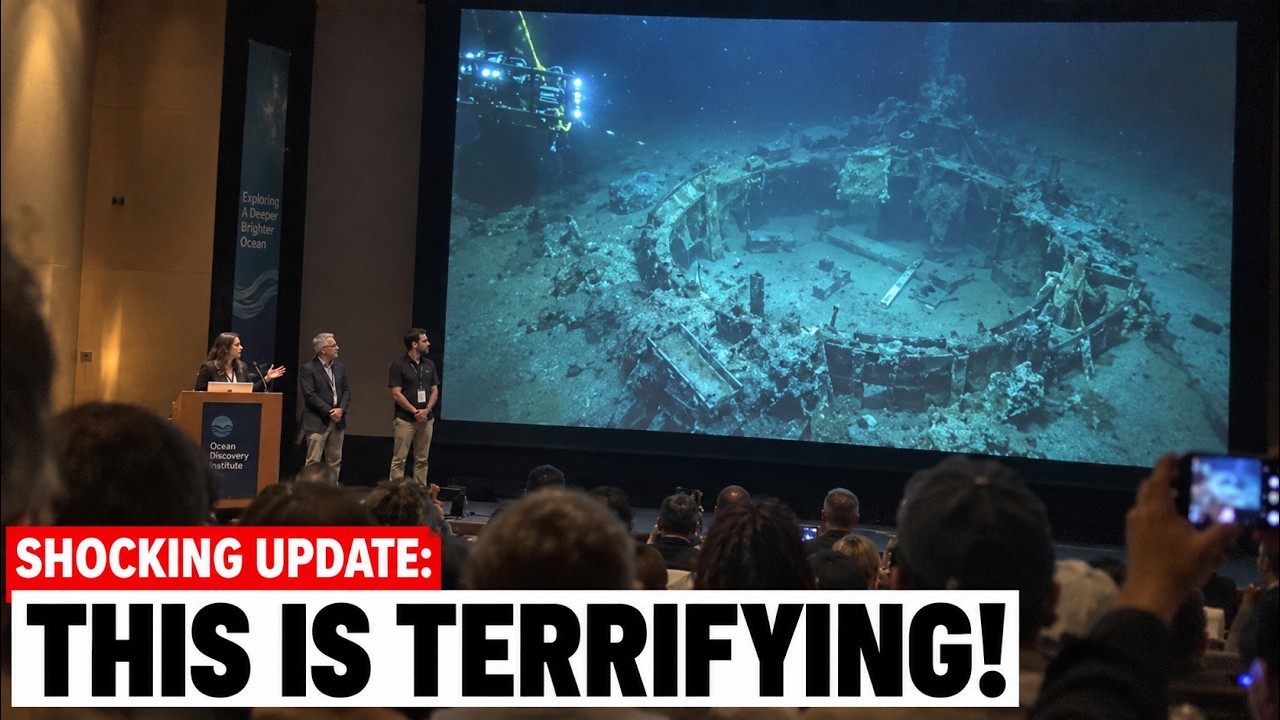
A famous discovery demonstrated this problem recently. In 2022, a documentary mission searching near Florida for traces of a lost aircraft encountered a large section of wreckage on the seabed. Divers and remotely operated cameras documented material that NASA later examined and confirmed belonged to the space shuttle Challenger. The vehicle had broken apart shortly after launch in 1986, and debris fell into the Atlantic.
This newly found section was not evidence that the Bermuda Triangle destroyed the shuttle. The cause of that disaster had been established through a major investigation involving failed rubber O-rings in cold conditions. The discovery proved something quieter. Huge, historically important wreckage can remain undiscovered in waters scanned for decades.
No single robot can search an imaginary triangle. Even the most capable remotely operated vehicle only sees a narrow corridor on each dive. Multi-beam sonar expands coverage, but positive identification still requires closer inspection. The proposed triangle covers an area comparable to several large nations and contains water ranging from shallow reefs to abyssal depths.
Surveying every square meter at sufficient resolution to detect wreckage would require enormous time, fleets of ships, massive funding, and continuous analysis. New sediment would bury some targets while the search continued. Headlines compress this scale into one exciting descent because audiences understand the idea of a camera reaching the bottom. The real expedition is thousands of survey lines, unconfirmed targets, technical failures, weather delays, and patient people naming files at midnight.
Most of the deep ocean remains unsurveyed. Global seabed mapping has accelerated through international efforts and improved sonar technology. Yet high-resolution coverage remains incomplete, and direct visual observation represents a tiny fraction of the floor. Satellite gravity data can indicate broad underwater features but cannot reveal small wreckage.
Ship-based sonar provides far greater detail along surveyed tracks. Autonomous vehicles can fly close to the terrain and produce finer maps, though covering enormous areas remains expensive. The Bermuda Triangle seems uniquely mysterious because culture spotlighted it. In reality, ignorance of the deep ocean is a global phenomenon.
Vast regions far from famous legends contain unsurveyed slopes, undescribed species, geological hazards, and human history waiting beneath darkness without the benefit of a catchy geometric name. That ignorance invites deliberate fabrication. Videos circulate showing alleged crystal pyramids, towering glass structures, aircraft lined up on runways, space bases, and impossible signals spotted beneath the triangle. Many reuse unrelated footage, computer-generated images, sonar data from other locations, or generic wreckage without verifiable coordinates.
Narrators cite unnamed research teams and secret agencies, then claim the absence of records proves a cover-up. Depths and technical measurements create a sense of documentation while avoiding any traceable expedition report. Real deep-sea discoveries produce navigation logs, sample records, vehicle specifications, institutional data, peer-reviewed analyses, and images with context. A genuine secret base would have produced more than a single cropped image cut off just before useful metadata began.
Mystery content prefers its evidence to travel light. In fact, the footage revealed something more unsettling. There is no single mechanism behind every loss in the triangle because there is no single environment, no single event type, and no reliable interconnected dataset linking them. Instead, investigators find a combination of storms, mechanical failures, navigation errors, structural problems, poor communications, strong currents, incomplete records, and vast search areas.
NOAA states there is no evidence that mysterious disappearances occur there more frequently than in other large, busy ocean regions. That conclusion does not mean every case has been resolved. Some remain genuinely unexplained for lack of conclusive evidence. It means “unexplained” describes our knowledge, not proof of a force operating outside nature.
The gap between those ideas built the entire legend. Nature does not need a curse to erase people. A sudden storm can sink a small ship. Shifting cargo can destabilize a vessel before any distress signal.
Running out of fuel can push an aircraft over deep water far from accurate radar coverage. Currents can scatter debris across hundreds of miles. Pressure can crush sealed spaces. Saltwater can corrode metal.
Organisms can cover surfaces, and sediment can bury what remains. Survivors may leave conflicting memories because trauma and confusion affect recall. Investigation files may contain errors because institutions are run by humans, a design flaw nobody has managed to fix. Put enough traffic inside a huge area and rare disasters will happen.
Choose only the mysterious cases afterward, and coincidence begins to look like a pattern designed by something intelligent. When the robot lights crossed the bottom, they did not reveal a machine causing ships to vanish. They revealed the conditions that make recovering lost vessels almost impossible. Absolute darkness, unstable slopes, strong currents, incomplete maps, crushing pressure, and a search area drawn far too large to ever complete.
They also found fragile life, invasive predators, and human waste that reached places no person had ever seen. That is what the Bermuda Triangle was hiding. Not a supernatural answer, but an ocean so vast that evidence can disappear within it without breaking a single law of physics. The unsettling footage did not prove the legend.
It explained why legends grow whenever nature removes the witnesses, scatters the wreckage, and leaves silence floating where an explanation should have been.