By the spring of 1945, German officers were discovering that their army had lost one of the oldest advantages in warfare. Inside their own borders, they found that American troops were moving across Germany with maps of German territory that were more accurate and up to date than the maps the German army possessed of its own country. The men who found those documents searched for a word to describe the situation: unfair. The story of how the United States came to know Germany better than the Germans did is not the story of a single weapon.
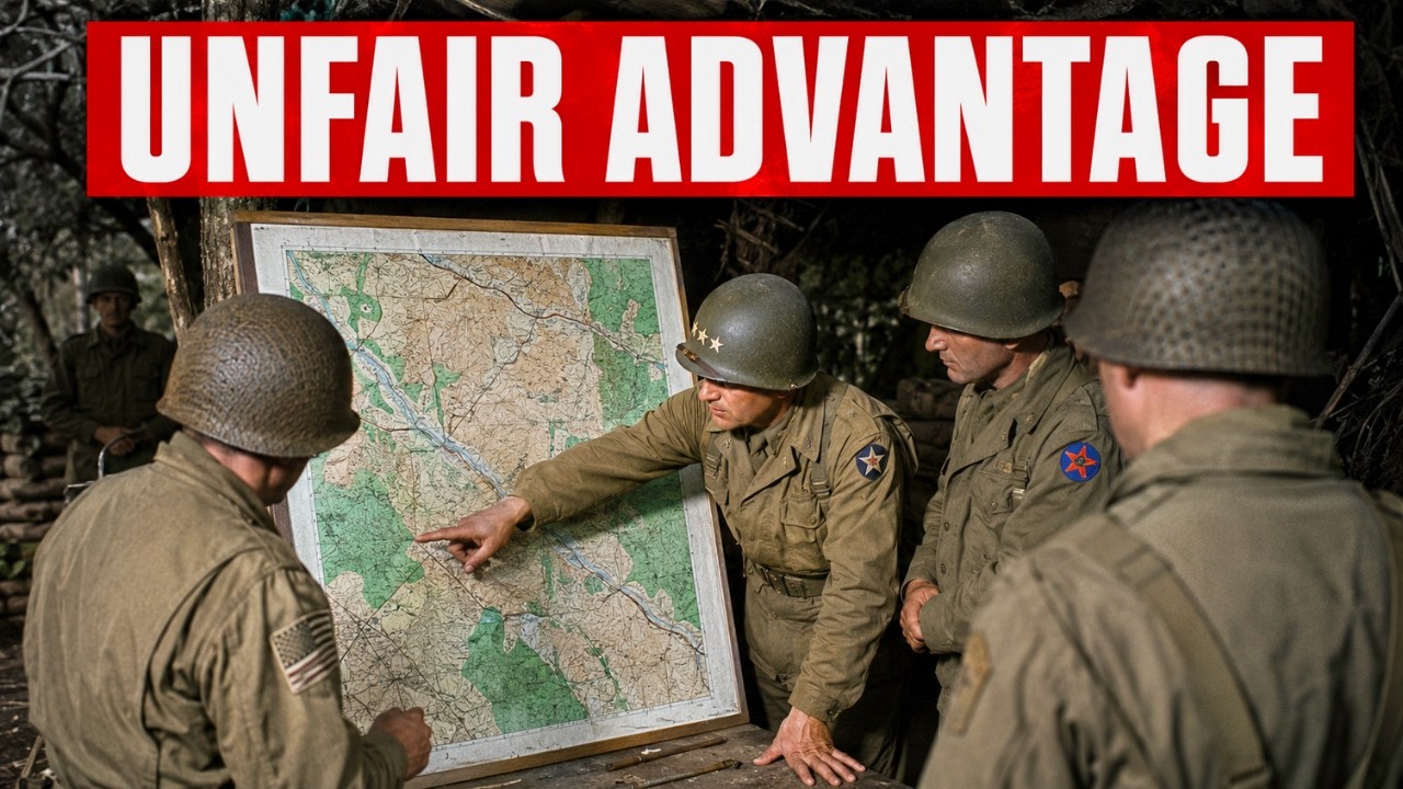
It is the story of an unarmed plane, a paper factory, and a small team sent to capture the enemy’s maps before they could be destroyed. The trouble began long before the final months of the war. In February 1943, the U. S.
Army was, as an organization for making maps, almost a joke. It possessed the most industrialized economy on Earth. Yet its soldiers in North Africa were fighting across terrain they could barely identify on paper. The catastrophe took shape in the hills of central Tunisia in the days before the Battle of Kasserine Pass.
Men of the U. S. II Corps were ordered to defend a line of ridges and passes along the eastern edge of the Western Dorsale mountains, which guard the approaches to the Tunisian interior. The maps they carried for this purpose were French colonial maps, most printed by the army’s Geographic Service years before the war, at small scales and with wide contour intervals.
Along the Mediterranean coast, the French surveys were reasonably good. Inland, where the actual fighting was about to happen, the maps degraded into optimistic approximations. A hill overlooking a valley might appear as a brown patch with elevation numbers beside it. The contour interval was so coarse that a change in the ground ten stories high could vanish between two lines.
An officer ordered to occupy a specific hill could stand on the wrong one without knowing it. On top of bad maps was bad command. The commander of II Corps, Major General Lloyd Fredendall, kept his headquarters far behind the front in a valley near Tebessa, never visited forward positions, and issued orders in a strange personal language his subordinates sometimes struggled to decode. His forces were scattered in small units across the terrain.
None of them conducted reconnaissance. When Field Marshal Erwin Rommel and German armored forces attacked through the passes on February 14, 1943, the American defenses collapsed. Over the following days, the II Corps was pushed back as far as 50 miles. American losses reached nearly 6,000 men killed, wounded, and missing, along with large numbers of tanks, armored vehicles, guns, and trucks.
The maps were not the only cause of what happened at Kasserine. Inexperience, poor positioning, and Fredendall’s failures in command did the most damage. But the maps were part of the wound. Soldiers called in artillery fire on grid squares that did not match the ground in front of them, requested support directed toward roads that were elsewhere, and withdrew because of terrain that turned out to be a kilometer from where the map placed it.
To understand why the richest nation in the war sent its soldiers into battle half-blind, it is necessary to look at what American military maps actually were before 1942. For the wider world, they barely existed. The United States had a respectable program for mapping its own territory, run by the Geological Survey and the Corps of Engineers, but it had almost nothing on foreign countries. There were no repositories of detailed maps covering Tunisia, Sicily, the coast of France, or the interior of Germany.
An army that had spent its interwar years small, weakly funded, and focused on its own hemisphere had never been asked to depict the land of distant continents, and so it had not done so. When American planners in 1941 and 1942 began seriously thinking about fighting in North Africa and Europe, the maps they needed simply were not in their hands. What filled the gap in those early campaigns was borrowed and improvised material. The first series issued for the Mediterranean and North African theaters relied heavily on British maps produced by the Geographical Section of the General Staff, the mapping arm of the British Army that had charted an empire and its approaches for generations, supplemented by old French colonial surveys and adjusted wherever possible with aerial photography.
American troops went to war reading other people’s maps that were being corrected as they went. In the worst cases, they relied on whatever commercial product could be found. The gap was not a failure of intelligence or courage. It was structural.
A country that had never built the machinery to see foreign land could not invent it in a single season. The institution that would ultimately close that gap had been established only months earlier. The Army Map Service was founded in 1942 by merging the map reproduction plant of the Corps of Engineers with the cartographic section of the War Department General Staff, bringing printing and assembly under one roof. Its headquarters was a facility in Brookmont, Maryland, on the edge of Washington, D.
C. , with origins in the copying plant that had served the army since the previous war. The man most associated with its founding was Charles H. Roth, a professional engineering officer whose name the main building later carried.
In peacetime, this organization printed a modest number of military maps needed by a small army, hardly worth mentioning. It employed a few hundred people and occupied cramped quarters. There was no sign in early 1943 that it was about to become one of the decisive industrial institutions of the American war effort. What changed everything was defeat.
The lesson learned from North Africa, absorbed quietly in Corps of Engineers offices rather than announced in headlines, was that an army that cannot see the ground it is fighting over will keep losing men for reasons unrelated to their courage. In the aftermath of the fighting in Tunisia, the Army Map Service accelerated an expansion that was already underway and pushed it with new urgency. Over the next two years, it grew from a few hundred employees to round-the-clock operations in every theater of the war. That decision, quiet and almost invisible at the time, was the first turning point of the story.
It committed the United States to solving a problem no army had ever solved on an industrial scale. On the other side of the lines stood the organization the Americans were determined to overtake. German military maps were venerable, deep, and respected. They were managed through the Heeresplankammer, the army’s central map office, and the broader surveying and mapping directorate that had mapped much of Europe, led by Lieutenant General Gerlach Hemmerich.
German sheets of foreign lands were often beautiful and precise, the product of a professional tradition that had spent decades refining its craft. In the 1930s, the Germans absorbed the survey records and cartographic offices of the countries they occupied, adding foreign data to their own. On paper in 1943, the German mapping establishment was the best in the world, and its officers believed it. But the German system carried a weakness that would only show under the pressure of a long war.
It was built on a peacetime model of map revision. Surveys were conducted, sheets compiled, printed, and revised at a slow pace suited to an established bureaucracy. The Germans did not fly high-altitude aerial reconnaissance over their own territory because there was no peacetime reason to photograph land they already controlled. These maps recorded the world as it had been surveyed, not as it changed from week to week.
As long as the front stayed fixed, that was enough. Once the ground itself began changing faster than a peacetime office could redraw it, the entire edifice began falling behind reality, with no quick way to catch up. The problem the Americans faced was harder than simply printing more maps. How do you map territory you are not allowed to enter?
How do you chart the interior of a country actively trying to kill anyone who approaches, and do it faster than that country can change its terrain? Solving this dilemma required more than draftsmen and presses. It required a way to see enemy territory from a distance, capture it accurately enough to build a map, and turn that raw material into finished maps on a schedule measured in weeks, not years. Part of the answer was already taking shape in an unexpected place: the Office of Strategic Services, America’s wartime intelligence agency.
Its map division, led by geographer Arthur H. Robinson, grew to about 150 people who produced nearly 5,000 maps for the war effort, including the situation maps used at the highest levels of Allied command. Robinson prepared and supervised the cartographic materials used at the major Allied conferences, including the Cairo and Quebec meetings where Roosevelt, Churchill, and their staffs shaped the course of the war. The men running American strategy were learning to think with maps in front of them.
Someone had to make those maps worthy of trust. Yet every map, however brilliantly drawn, depended on data someone had to actually go out and collect. A draftsman could not draw what had not been delivered to him. And the land the Americans most desperately needed to see was under German control, protected by anti-aircraft guns and fighters flying thousands of feet below the only aircraft that could reach it.
If the United States wanted to map enemy territory, someone would have to fly over it alone and come back with the picture. The scale of what North Africa demanded, once the fighting expanded beyond Tunisia, makes the starting point even clearer. The North African campaign as a whole ultimately required about a thousand different maps, from which nearly 10 million copies were printed to supply forces operating in Morocco, Algeria, and Tunisia. That was a huge number by prewar army standards, yet small compared with what was to come.
The fact that a campaign of that size began with officers reading French colonial maps, and in some accounts tourist road maps of the kind a traveler might carry, shows how far behind the army had been at the start and how fast it now had to move. The core technical problem was terrain accuracy, the depiction of high and low ground. A tactical map lives or dies by its contour lines, those thin closed curves that tell the soldier whether he is going uphill or down, and how steep the slope is. In the French maps of Tunisia, the contour interval was wide, meaning the lines were far apart in height, so that country looking easy on paper could hide sharp folds of ground in reality.
A commander planning to move armor across what looked like a gentle slope might find the real incline too steep for his vehicles, or a hill identified as a single feature might actually be two hills with a dead zone between them where the enemy could wait unseen. The difference between a good and a bad map was not decoration. It was the difference between arriving where you intended and in the intended formation, and arriving somewhere else scattered and exposed. This was the standard the Army Map Service now had to meet, not for one campaign but for every theater simultaneously, and not from existing surveys but from territory held by the enemy.
An institution that had printed almost nothing in peacetime was asked to depict the entire surface of the war. The decision to try, taken in the aftermath of Kasserine Pass, set in motion the machinery that drives the rest of this story: the reconnaissance aircraft that would photograph the ground, the interpreters who would turn images into measurements, and the drafting force that would turn measurements into maps a soldier could unfold in the field. The first of those parts was the lone plane flying straight and steady over enemy cities. The aircraft that flew over enemy territory was a P-38 Lightning, stripped of everything that had made it a fighter.
In its photographic form, it was designated the F-5. Where the fighter carried machine guns and a cannon in its nose, this one carried cameras. The F-5 carried cameras, usually arranged as several mounted to look directly downward and to both sides. The most demanding configuration was trimetrogon photography, a system developed in the United States in which three cameras were exposed at once, one pointing straight down and two angled outward so that a single pass captured everything from horizon to horizon.
The overlapping images could later be assembled into continuous coverage of a strip of territory miles wide. From that overlap, interpreters could extract the third dimension, the elevations and slopes tactical maps required, not just a flat picture. The pilot paid the price for that coverage. To produce images that matched up properly, the aircraft had to fly straight and level on a constant course and altitude, often above 20,000 feet, holding the path while the cameras worked.
A fighter pilot under threat could turn, climb, dive, or take evasive maneuvers with his aircraft. A reconnaissance pilot on a photography mission could not. Once he left the course, the images were useless and the mission wasted. The F-5 carried no defensive armament at all.
Its protection lay in altitude and speed, and the hope of leaving before German anti-aircraft crews found its range or fighters rose to intercept. Reconnaissance aircrews recorded some of the highest loss rates among Allied pilots who were not flying bombers. And they did it without firing a shot or claiming a victory. The units that flew these missions over Europe operated from airfields in England, including the American reconnaissance group based at Mount Farm near Oxford, which photographed targets across occupied France and the German Reich.
Their images were the raw material without which no accurate map of enemy territory could be drawn. One of the men who did this work had another life after the war. The French writer and pilot Antoine de Saint-Exupéry, author of the book generations know as The Little Prince, flew an F-5 in the Mediterranean and disappeared on a reconnaissance mission on July 31, 1944. His aircraft was lost over the sea off southern France.
The wreckage was not identified for more than half a century. He was one of many. Most reconnaissance pilots who did not return left behind no book, only a gap in the squadron record and a roll of exposed film that may or may not have survived with them. The pilot’s images were only the beginning.
A pile of overlapping aerial photographs is not itself a map. It is a collection of images taken from a moving aircraft and distorted by camera angle, aircraft tilt, and lens curvature. It means little until someone measures it, interprets it, and turns it into lines on a sheet. That work was done in photographic interpretation centers, and the largest and most important of these in Europe grew up in a country house called Danesfield in Medmenham, Buckinghamshire, England, where the Allied Central Interpretation Unit brought British and American interpreters under one roof.
That operation grew with the war. What began as a small British interpretation section expanded into a joint Allied project, its staff rising from a few hundred to more than 1,700 people, sorting and studying an ever-increasing flood of images arriving from reconnaissance flights over all of occupied Europe. The interpreters worked with stereoscopic technique, placing two overlapping photographs of the same area side by side and viewing them through instruments that fused the pair into a single three-dimensional image, with hills rising out of the print and valleys sinking below it. From that fused image, using plotting instruments that could measure the displacement between the two photos, they were able to extract elevations and contour lines with high accuracy.
Machines such as the Wild plotters made in Switzerland turned the displacement between two aerial photographs into measured heights, the essential step that turns an image into a map. The interpreters at Medmenham did more than measure terrain. They read the ground for meaning, identifying gun positions, bunkers, radar sites, airfields, and the slow accumulation of new construction that revealed what the enemy was building. For the planning of the invasion in particular, the unit produced detailed three-dimensional raised-relief models of parts of the enemy coast, built from photographic evidence.
Hundreds were made so that the men who would land on the beach could study the shape of the ground before they saw it with their own eyes. The photographic archive that passed through this work ran to millions of images, a library of enemy territory assembled without a single foot set upon it. On the American side, the same conversion from images to maps was performed by army topographic engineering units, specialized battalions deployed in the theaters with plotting and reproduction equipment. Multiplex-type instruments projected overlapping images so the operator could trace contour lines directly from the fused image.
The topographic engineering battalions, including units carrying numbers in the six hundreds, carried this capability to the fronts, assembling and printing maps closer to the battle lines than any peacetime planner would have imagined possible. By mid-war, the drafting rooms were increasingly staffed by women, with male geographers and draftsmen conscripted into military service. The Army Map Service filled its drawing rooms with young women recruited from university programs, put through intensive courses, and set to work at light tables. Inside the organization, they earned the nickname Army Map Girls.
The courses that qualified them were held at colleges around the country. The first year of one such training program produced about 200 qualified women who went straight into map work, and certain institutions became major sources of supply. Kent State University in Ohio, in particular, sent a stream of its geography students to the Army Map Service. By the latter part of the war, women made up more than half of the Army Map Service workforce, a striking fact at the time and almost entirely absent from public memory of the war.
The work itself was precise in a way that is easy to underestimate. A draftsman at a light table copied contour lines and detail from a compiled source onto a drawing surface using pens with lines finer than a hair, with the margin of error measured in fractions of a millimeter. A slip of the pen moving a contour line slightly changed the apparent steepness of a slope. A road drawn inaccurately might send a tank platoon toward a rise it could not actually climb.
A break in a contour misplaced by a fraction could put a company on the wrong ridge. The women in those drawing rooms were not producing illustrations. They were producing accurate terrain that men who did not yet know their names would move across, and the difference between a correct sheet and a dangerous one was very small. What set the American effort apart from any other mapping establishment in the war was not the skill of any single draftsman or the quality of any single sheet.
It was the scale and the industrial system that produced it. Between 1941 and 1945, the Army Map Service prepared tens of thousands of different map titles and printed nearly 500 million individual map sheets. An organization that employed a few hundred people in peacetime employed more than 3,500 at the peak of the war. To visualize the output in physical terms, later observers calculated that if the nearly 500 million sheets were stacked on top of one another, the pile would rise miles high, far higher than any structure humans had built.
This was not craft in the old sense. It was manufacturing, the same industrial logic that filled the seas with Liberty ships and the skies with bombers. It had now been turned to producing paper that could see. Faced with that, the German establishment, for all its inherited excellence, could not match the pace.
The reason was structural more than a matter of talent. The German map office had been created to revise sheets based on surveys conducted at the leisurely pace of peacetime. It did not conduct high-altitude aerial reconnaissance over territory it already controlled, so it had no fast mechanism for recording changes on its own soil or on ground that daily construction and warfare were altering. Nor did it have an industrial production line working day and night at the American scale.
The Germans could still produce beautiful, accurate maps of correctly surveyed terrain. What they could not do was update at the speed of an army that photographed the ground from the air one week and printed corrected sheets the next. The imbalance that astonished German officers in the end was not a matter of American draftsmen being more talented. It was because the United States had built a machine for seeing ground, and Germany had not.
All these capabilities were converging during 1943 and into 1944 on a single operation whose name those planning it were not allowed to mention. The invasion of northwestern France required map support of a type and quantity without precedent. The Allies poured more than two years of accumulated photographic intelligence into it. The mapping program for the Normandy landings and the campaign that followed produced about 3,000 different maps.
The total number of individual sheets printed and shipped for the invasion and the fighting in Normandy was nearly 70 million copies. For a single operation, that figure is hard to absorb. It represented a deliberate decision that no soldier would set foot on contested ground without the most accurate possible picture of it that the system could produce. The most detailed assault sheets were drawn at large scales up to 1:12,500, a scale in which a short distance on the map corresponds to a very short distance on the ground, close enough to show the individual features the landing force needed to see.
These were among the most detailed tactical maps ever produced for a military operation to that date. Behind the maps lay an intelligence problem specific to amphibious assault: the need to know the beach itself, not just the ground behind it. Planners had to know the slope of the sand at the waterline. A beach too flat would ground landing craft far offshore and force infantry to wade under fire.
A beach sloping differently in different sectors required different craft and different timing along the same few kilometers of coast. They had to know which sand would bear the weight of a tank and which would swallow it. They had to know the obstacles and mines the Germans had planted just below the surface. The Allies assembled that knowledge from a mix of sources.
Stereoscopic aerial photography taken by reconnaissance aircraft provided a continuous record of the coast and its defenses. Old civilian material was collected, including prewar photographs and tourist postcards of Normandy beaches, because they showed the shoreline as ordinary visitors had once seen it. Geological studies of the coast written by academic researchers for entirely peaceful purposes were also used. Most directly of all, small teams went at night in midget submarines and collapsible boats to the enemy shore, where swimmers slipped into the water to collect sand samples and measure the beach by hand, then withdrew unseen.
From all of this, the planners built a profile of the invasion coast accurate to the meter and updated weeks before the landings, with editions continuing to print until the moment they were loaded onto ships. The result was that Allied artillery could adjust its fire onto German positions before the first ship touched the sand, and every assault unit could be sent to the sector its briefing described in the formation the ground required. It would be wrong to portray this superiority as flawless. The honest measure of it lies in the places where it failed.
The ground behind the Normandy beaches was bocage country, terrain of small fields divided by earthen banks topped with dense hedgerows grown over centuries into walls of roots and thorns. These hedgerows were visible in aerial photographs and appeared on the maps. What the planning understated was not their existence but their tactical ferocity, the way every earthen bank turned into a ready-made fortification funneling attackers into killing zones and turning every field into a small, separate battle. The senior American engineer responsible for terrain intelligence later admitted that his institution had not understood how difficult the hedgerow country would be.
The maps showed the lines. They did not convey the cost of crossing them. The Pacific war offered a sharper reminder that the American map machine had limits wherever its raw material ran short. At Peleliu in the Palau Islands, the Marines who landed in September 1944 found that the prewar maps of the island were weak, and that aerial reconnaissance had failed to reveal the true nature of the ground: a series of coral ridges full of caves that did not show clearly from the air.
The result was a battle far longer and bloodier than planners expected, fought across terrain the maps did not accurately describe, even though aircraft could see and photograph it freely. The American picture of the ground was vast. Wherever clouds or heavy cover blocked the camera, the advantage shrank, and men paid for the gap. The system was powerful, but it was not omniscient, and its power depended entirely on the ability to see.
That distinction pointed toward the next stage of the war. As long as the fighting continued in France, the American advantage rested on photographing and mapping ground held by the enemy faster than the enemy could. But the armies were driving toward Germany itself, and inside the Reich something was waiting. The aerial camera could not simply photograph from 20,000 feet the accumulated survey records of the German state, the master framework of measured reference points on which every accurate German map was built.
Capturing that would require not a pilot flying alone over a city, but men on the ground moving into captured towns to seize the enemy’s own maps before they could be destroyed. The paper advantage was about to become something more direct, carried into Germany by a small team following just behind the front lines. The surveying effort deserves to be understood in its full scope because the photographic image was the foundation on which everything else stood. A trimetrogon pass did not record just one place.
By flying a planned pattern of parallel lines with each line overlapping the previous one, continuous coverage was built up over large areas of ground. The value of that coverage lay as much in repetition as in scope. A stretch of coast or a road junction photographed once gave interpreters a single frame. The same ground photographed again weeks later gave them change, and change meant intelligence.
A fresh scrape of disturbed earth where there had been nothing, a shadow pattern that had not existed on the previous print, the faint geometry of a gun pit under camouflage netting, all of it emerged from comparing one date with another. This was the mechanism that allowed the Allies to watch the enemy building defenses almost in real time. It existed only because pilots repeatedly flew over the same dangerous ground, and interpreters patiently compared the results. Interpretation itself was a science that had to be learned, not improvised.
A photograph taken from 20,000 feet does not announce what it shows. The trained interpreter learned to read the length and direction of shadows to calculate a structure’s height, to distinguish a real gun from a dummy by the signs of use around it, and to recognize the fingerprint of a radar station or missile site from construction patterns. The best interpreters at Medmenham became famous within the intelligence world for pulling from a single image details others had completely missed. The terrain they measured fed directly into the maps the armies would carry.
The relationship between the interpreter staring through a viewer in an English country house and the soldier unfolding a map on a beach in France was direct, though neither ever met the other or knew the other’s name. The drafting rooms carried the same burden of accuracy at the far end of the chain. The women at the light tables worked long hours under deadline pressure, because a unit in the field needing a map did not wait for normal business hours. A single detailed map could take long hours of skilled labor to compile.
The standard for a new large-scale sheet required hundreds of hours of cartographic work before it was ready for printing. Multiply that effort by tens of thousands of titles, and the human cost of this project, measured in hours of patience rather than blood, becomes clear. The output later reduced by observers to a single pile of paper miles high was in fact the accumulation of millions of individual acts of precise drafting, performed by people who understood that a soldier’s life might depend on the accuracy of a single line. Printing and distribution mattered as much as drafting.
The presses ran continuously. The supply chain moved finished sheets across the ocean to the front, and the process was large enough to absorb losses without stopping. That manufacturing tempo, more than the quality of any single map, was the advantage the Germans could not answer once their printing capacity came under sustained air attack and their centralized operations had to disperse. The man who would carry the paper advantage into German territory was a civil engineer named Floyd W.
Hough, 46 years old, a Cornell graduate who had spent his career surveying difficult terrain. He had managed survey expeditions in the American West for the government and planned terrain in South American forests for oil companies. By the time of the war, he headed the geodetic section of the Army Map Service. Geodesy is the science of measuring the shape of the earth and establishing precise reference points upon it, the invisible framework beneath every accurate map.
Hough understood, more than almost anyone in American cartography, that the finished German map was merely the surface of something deeper. Beneath it lay the survey network, the master framework of measured points on which German maps had been built for decades. If you captured the maps, you had maps. If you captured the network, you could make better maps than the Germans could make themselves.
Hough traveled to Europe in late 1944 at the head of a special small team, a mixed group of about 19 men that included geographer Edward S. Bensched, and among its investigators one of the German-born soldiers later known as the Richie Boys, Hans Jacob Mayer. They carried special passes from Supreme Headquarters Allied Expeditionary Force allowing them to move with the advancing troops and enter captured cities ahead of the normal occupation apparatus. Their mission was urgent for a specific reason.
As the Reich collapsed from within, German survey records were being moved and hidden, and much of the country toward which the Americans were advancing would soon fall within the Soviet occupation zone already agreed upon by the Allies. Any cartographic treasure in central Germany had to be found and removed before its owners destroyed it or before it was lost behind the line the Americans would not cross. The first attempts showed how narrow the time margins were. Aachen, the first major German city to fall, was captured in October 1944 after fighting that left much of it in ruins.
When Hough’s men searched it, they found that the survey records they wanted had already been moved before the city fell. The lesson was not failure but methodology. A team following right behind the front could reach cartographic targets in any captured city within days. Where materials had been evacuated, they could at least learn where they had gone.
Then the German counteroffensive in the Ardennes in December 1944 put the entire Western Front on the defensive. Hough’s work stalled along with everyone else’s as the armies fought through the winter. Only when the front began moving again in early spring 1945 did the richest finds arrive. They came in rapid succession as the armies pushed deep into Germany.
In Wiesbaden, the team recovered bundles of survey data the German authorities had classified and hidden, covering thousands of reference points across the southwest of the country. Hough immediately realized this was not merely archive material for postwar study. It had immediate operational value because the U. S.
Seventh Army was at that moment fighting precisely across the territory those data described. Survey controls of this kind translated directly into accurate artillery fire. Instead of sending the material back through slow intelligence-processing channels, Hough passed it forward to the gunners who needed it. American artillery crossing into that region of Germany was directing its fire using the German survey system the German government had classified only weeks earlier, now used against the army that had compiled it.
The greatest prize was still waiting, and it was reached through interrogation rather than search. A captured officer from the Reichsamt für Landesaufnahme, the German land survey office, revealed that the most important cartographic secrets had been moved from Berlin as bombing intensified, hidden in small towns within the hill country of Thuringia, far to the east. These were places that had not appeared at all in Hough’s original target lists. Based on that information, the team raced toward the town of Saalfeld, where a central depot of German army maps and survey holdings had been moved, arriving in mid-April 1945, in the days following the town’s fall to American troops.
Those who catalogued what they found there later called it the greatest capture of its kind ever obtained from an enemy in wartime. It was the accumulated surveying framework and map production of the German state, the institutional memory of one of the world’s finest military cartographic traditions, now in American hands. The physical booty matched the significance. Hough’s team collected the material for transport ahead of the Soviet advance, selecting and packing what mattered most.
The quantity that eventually reached the Army Map Service totaled about 90 tons of maps and survey records, including nearly 100,000 maps, along with the precision instruments that had made German cartography possible, including seven massive Zeiss multiplex plotters used to turn images into measured maps. The team also captured the people who understood the data. Among those taken into American custody was Lieutenant General Gerlach Hemmerich, the senior figure in the German surveying and mapping establishment, the man who had stood atop the very system the Americans had spent two years overtaking. The reversal was now complete and literal.
The Americans possessed not only their own superior maps of Germany but also the German master’s survey of his own country, and German experts to interpret it. By that spring, the contrast between the two sides was total. The German mapping system had effectively collapsed. Allied bombing had destroyed its printing capacity.
Its central operations had been driven out of Berlin and scattered into hideouts. The men who ran it were dead, captured, or working under American supervision. A German commander inside his own country in the final weeks of the war might wait in vain for an updated sheet for his sector, because the supply line that was supposed to produce it no longer functioned. On the other side of the line, American units were moving across that same German ground carrying maps far more current than anything the defenders possessed, printed far away and shipped forward on a schedule the collapsing Reich could never match.
This is the answer to the question the whole story poses: how a nation with no tradition of surveying foreign territory ended up knowing the enemy’s country better than the enemy did, and why German officers reacted the way they did. Across all European military history, there had been one comfortable advantage the defender always held. A national army knew its ground in a way no invader could match. The roads, rivers, and terrain learned over generations.
Napoleon had been broken against a Russia he could not understand or read. Armies had always been able to rely on the ground beneath their feet being their own. By the final year of the war, that oldest of advantages had been stripped from the German army inside its own borders. Not by betrayal, not by any single weapon, but by a system that photographed the ground from the air, measured it, drew it, and printed it faster than the country that possessed it could keep track of its own terrain.
For a professional soldier raised to believe his general staff was the finest in the world, discovering that enemy maps of Germany were better than Germany’s own maps could only be described as unfair. As if the Americans had broken an unwritten rule about how war was fought. The men who actually commanded against the Americans understood that the map was just one face of a larger reality. Field Marshal Gerd von Rundstedt, who led German forces in the west, gave after the war a blunt explanation of what had defeated him there.
He cited the overwhelming superiority of Allied air power that made movement in daylight impossible, the fuel shortages that paralyzed his tanks, and the systematic destruction of the railways that meant he could not move his forces to where they were desperately needed. Each of those factors was a form of the same thing the maps represented: an enemy who could see the battlefield, reach it, and organize it on a scale and at a pace Germany could not match. The map was the quiet version of that superiority, the one that never exploded and never appeared in any official statement. That was precisely why it was the hardest for German generals to talk about later.
It was easier to speak of air power and fuel than to admit that the enemy knew the ground better than the men defending it. The captured German surveys did not disappear into storage after the war. Hough arranged for German geodesists to continue their computations under American supervision, merging the German reference network with data gathered by the Allies. From that work came a unified survey of central Europe.
That framework expanded in the following years to become the European Datum of 1950, the first common geodetic remnant binding the continent in a single measurement, and it became part of the foundation on which later mapping and coordinate systems of the West and NATO were built. The sheets produced by the drafting rooms and reconnaissance squadrons won the war. The survey data gathered at its end helped shape how the Western military world measured the ground for decades to come. The story that begins with a bewildered American lieutenant reading a French colonial sheet in Tunisia and ends with a captured German general is not ultimately a story about paper.
It is a story about what it means for one side in a war to see clearly while the other cannot. The United States entered the war unable to picture the ground on which its soldiers were dying. It treated that blindness as a problem to be solved with industry and organization rather than accepted as bad luck, and in a little over two years built a system that could map the enemy’s country with greater accuracy than the enemy himself. That advantage cost the German army in ways that never made headlines and were never carved on any monument: tanks massed on roads that were not where the old maps had promised, positions fixed on American sheets that the defenders had thought secret, artillery hitting its targets from the first minute because the ground had already been measured.
This reversal was of the kind a defeated professional could only describe as unfair. And in that word lay the truest compliment such a man could offer. It was an admission that they had not merely been beaten in the field, but in the quieter business of knowing where the field actually was. The nature of the Saalfeld capture deserves to be fully understood because it explains why cartographers considered it unique rather than merely massive.
An ordinary capture of enemy maps gives you only sheets. Sheets can be copied, but they age as the ground changes, and they reveal nothing about the measurements beneath them. What made the German holdings exceptional was that they contained the control itself: the triangulation records, the points, the coordinates of the fixed points from which every map had been derived. With those in hand, the army inherited not a pile of German maps but the ability to compute new positions anywhere within the German frame, to locate a target, a battery, or a boundary with the same accuracy the German surveyors had achieved, and to extend that accuracy with its own photographic methods.
This is why Hough insisted from the start that the survey network, not the printed map, was the true objective. The map was only an answer. The network was a means of generating answers. The decision to keep the German experts at work, rather than simply seizing their records and arresting them, was deliberate and had enormous consequences.
Data of such complexity would not interpret itself. The reference systems, conventions, and reductions that turned raw survey observations into usable coordinates existed partly in documents and partly in the minds of the men who had built them. By incorporating senior German surveyors into work under American supervision and tasking them with matching their network with Allied data, Hough preserved not just the records but the expertise needed to use them. He did it at the crucial moment when that expertise could have been scattered in the chaos of a collapsing country or lost behind the Soviet line.
The result was that the transition from German to Allied control of central Europe took place without the loss of continuity that usually accompanies the fall of state institutions. Even before Germany fell, captured commanders were telling their interrogators that the Americans often seemed more familiar with the local terrain than the German units that had controlled that ground for years. That did not come from spies in every village. It came from the machine described in this report: the reconnaissance aircraft, the interpreters, the drafting rooms, and the map presses working in a sequence no other army had assembled.
By the time the Americans stood inside Germany holding the Germans’ own surveys, the reversal was no longer a curious impression mentioned by prisoners. It was a fact of the war, embodied in 90 tons of crates heading for Washington. The home team had lost the advantage the side playing on its own ground had always kept.